
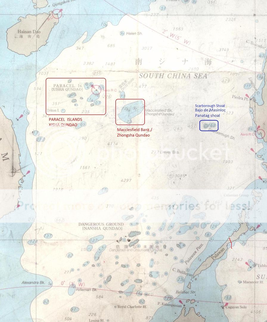
Scarborough Shoal - or to what Philippines refers to as Panatag Shoal or Bajo de Masinloc - is one of the crucial disputed land formations between the two countries, It lies about 118 nautical milesa west of Zambales province and withing the Philippines' 200 nautical mile exclusive economic zone (EEZ), as specified by the United Nations Convention on the Law of the Sea (UNCLOS).
In April 2012 a Philippine warship tried to arrest Chinese fisherme, whose presence in the shoal was illegal.
The Chinese Coast Guard intervened, resulting in a standoff that went of for months,
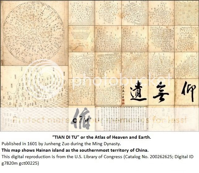
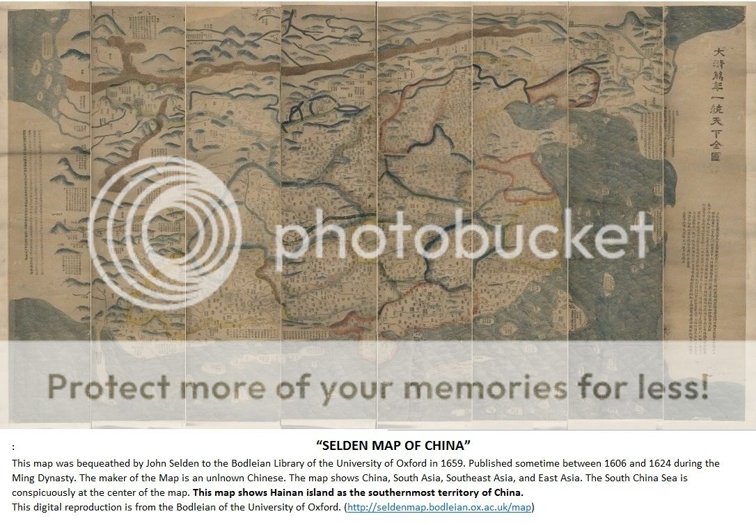
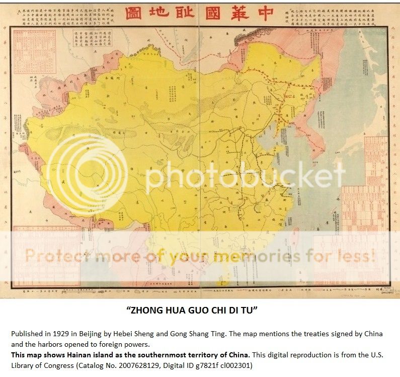
China says it has owned Scarborough for centuries, based on what it calls its historical rights to the area.

But the oldest known map of the Philippines - the Velarde-Murillo Map of 1734 - shows Panatag Shoal, then called Panacot Shoal, as part of "Las Islas Filipinas" or the Philippine islands which were then administered by Spanish colonizers.

The 2012 standoff ended only after Manila and Beijing agreed to pull out.
But China did not stop, it sent its patrol ships back and eventually closed off the shoal to Filipinos.
The move would set in motion the Philippine maritime case against China before the Permanent Court of Arbitration in The Hague.
But no one knows the gravity of the situation like the fisherfolk of Masinloc.
Their only source of livelihood has been the shoal for as long as they can remember.
And now they have been restricted to the area, they\re losing 300 thousand pesos a week.
From CNN Philippines :
West Philippine Sea 101 - Scarborough Shoal
http://cnnphilippines.com/news/2015/07/23/west-philippine-sea-101-scarborough-shoal.html
West Philippine Sea 101 - Scarborough Shoal
http://cnnphilippines.com/news/2015/07/23/west-philippine-sea-101-scarborough-shoal.html
* * * * *
Related maps
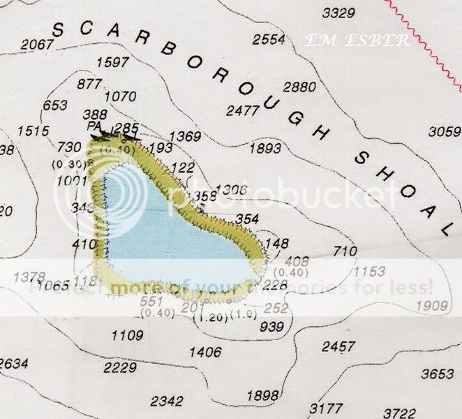


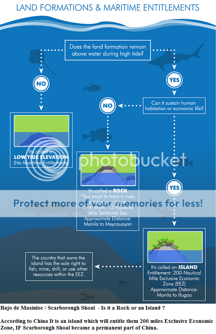
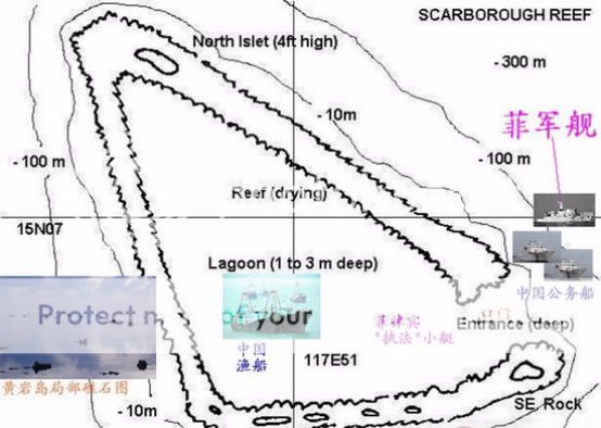

Bajo de Masinloc / Scarborough Shoal is a Rock since it cannot sustain a human habitation or economic life. The rock is located in the North east and South east part of the shoal.


* * * * *
Ancient Chinese Map


* * * * *
Related story :
West Philippine Sea 101 – Land Formations & Maritime Entitlements
Permanent Court of Arbitration – Philippines versus China
Spratly Islands and Bajo de Masinloc in Ancitne Chinese Maps. Spanish and other Foreign Maps.
The Geopolitics of Panatag Shoal (Bajo de Masinloc
http://jaimedelacruzblog.blogspot.com/2016/05/the-geopolitics-of-panatag-shoal-bajo.html
South China Sea Dispute
MARCHA infront of China Consulate at Makati – 24 July 2015
http://jibraelangel2blog.blogspot.com/2015/07/marcha-infront-of-china-consulate-at.html
Three Centuries of Philippine Maps – 1598 to present era.
http://jibraelangel2blog.blogspot.com/2015/11/three-centuries-of-philippine-maps-1598.html
Chinese “occupation” of Bajo de Masinloc could reduce PH territorial waters by 38 percents.
http://jibraelangel2blog.blogspot.com/2013/01/chinese-occupation-of-bajo-de-masinloc.html
* * * * *
YouTube
China Prepares for New Land Reclamation at Scarborough Shoal.
Documentary - Inside and Around the South China Sea
Philippines vs China, Vietnam vs China - compilation
No comments:
Post a Comment