A Cartographic Exhibit
Based on the 06 June 2014 Lecture of
Supreme Court Senior Associate Justice Antonio T. Carpio
Maps merely constitute information which varies in accuracy from case to case; of themselves, and by virtue solely of their existence, they cannot constitute a territorial title, that is, a document endowed by international law with intrinsic legal force for the purpose of establishing territorial rights." Burkina Faso/Republic of Mali (1986 I.C.J. 554)
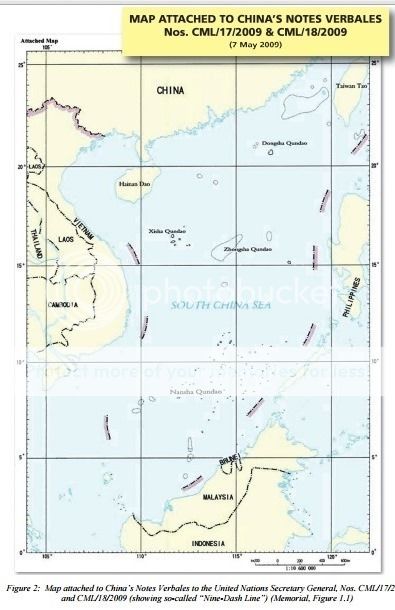
Thus, a state cannot enlarge its rights under international law by its own unilateral acts or domestic legislation. Yet, this is exactly what China did in 1947 when China drew its nine- dashed line map in the South China Sea, claiming as basis historical facts.
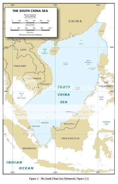
Despite the irrelevance of historical facts to present-day maritime claims under the United Nations Convention on the Law of the Sea, ancient maps of China made by Chinese authorities, Chinese individuals or foreigners, and ancient maps of the Philippines made by Westerners, Philippine authorities or individuals, vividly present the actual historical facts in the South China Sea.
Historical Truths and Lies - Scarborough Shoal in Ancient Maps
http://www.imoa.ph/imoawebexhibit/
* * * * * *

* * * * * * *


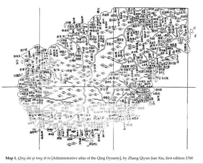
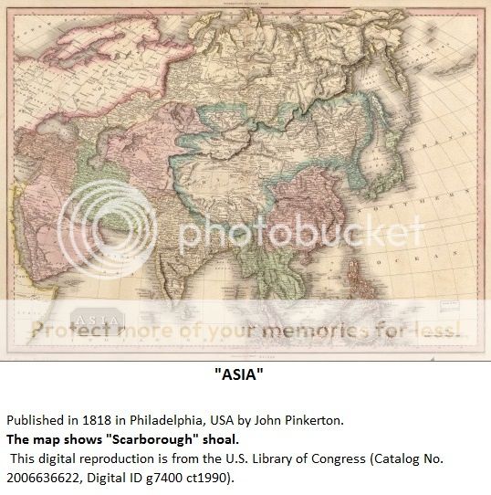
Map of China during Ming Dynasty not showing Scarborough shoal or Spratly
as part of China.
* * * * *
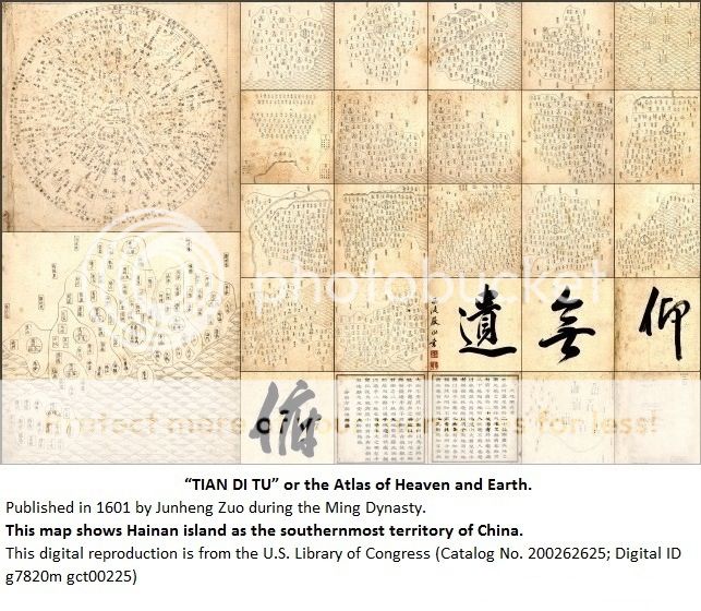
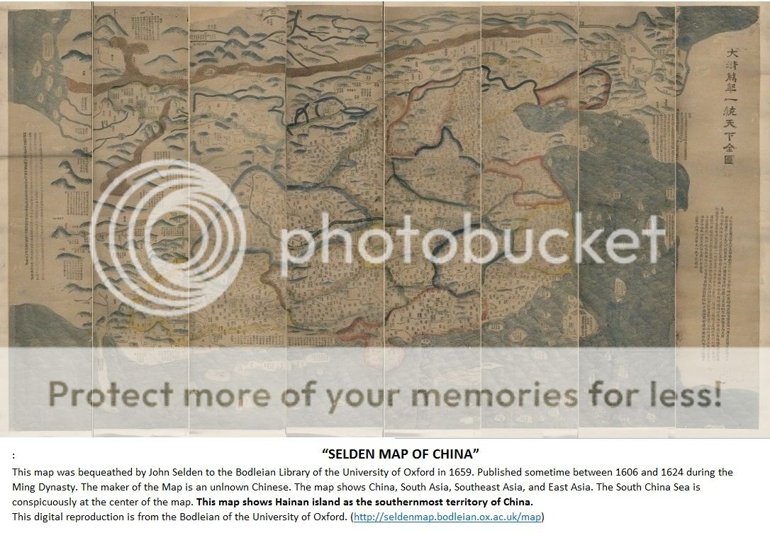
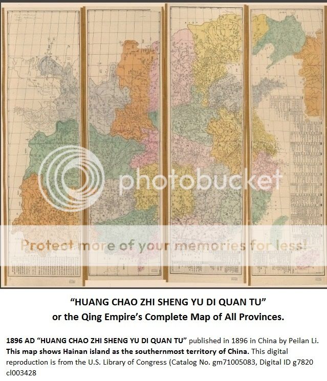
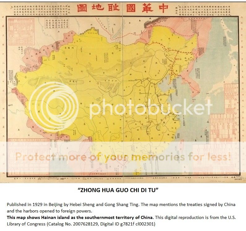
Ancient Chinese maps showing Hainan island as the southernmost territory of China.
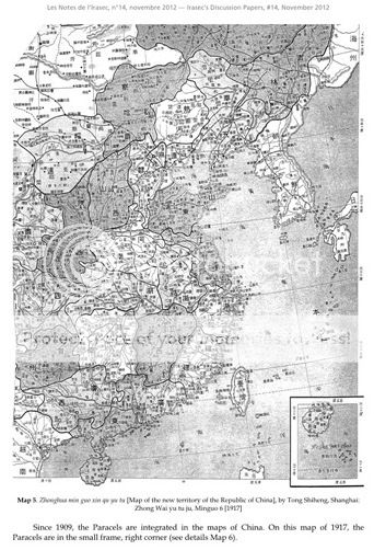
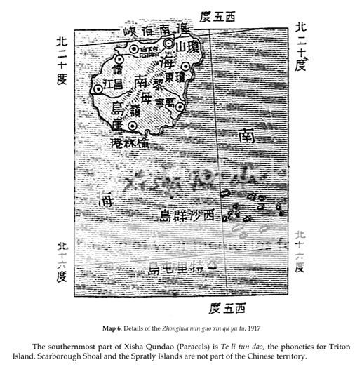
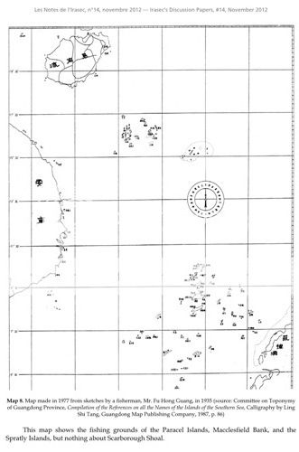
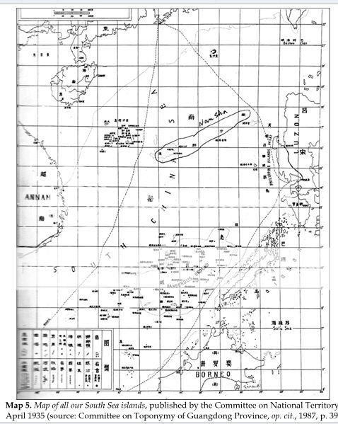
From IRASEC


* * * * * * *
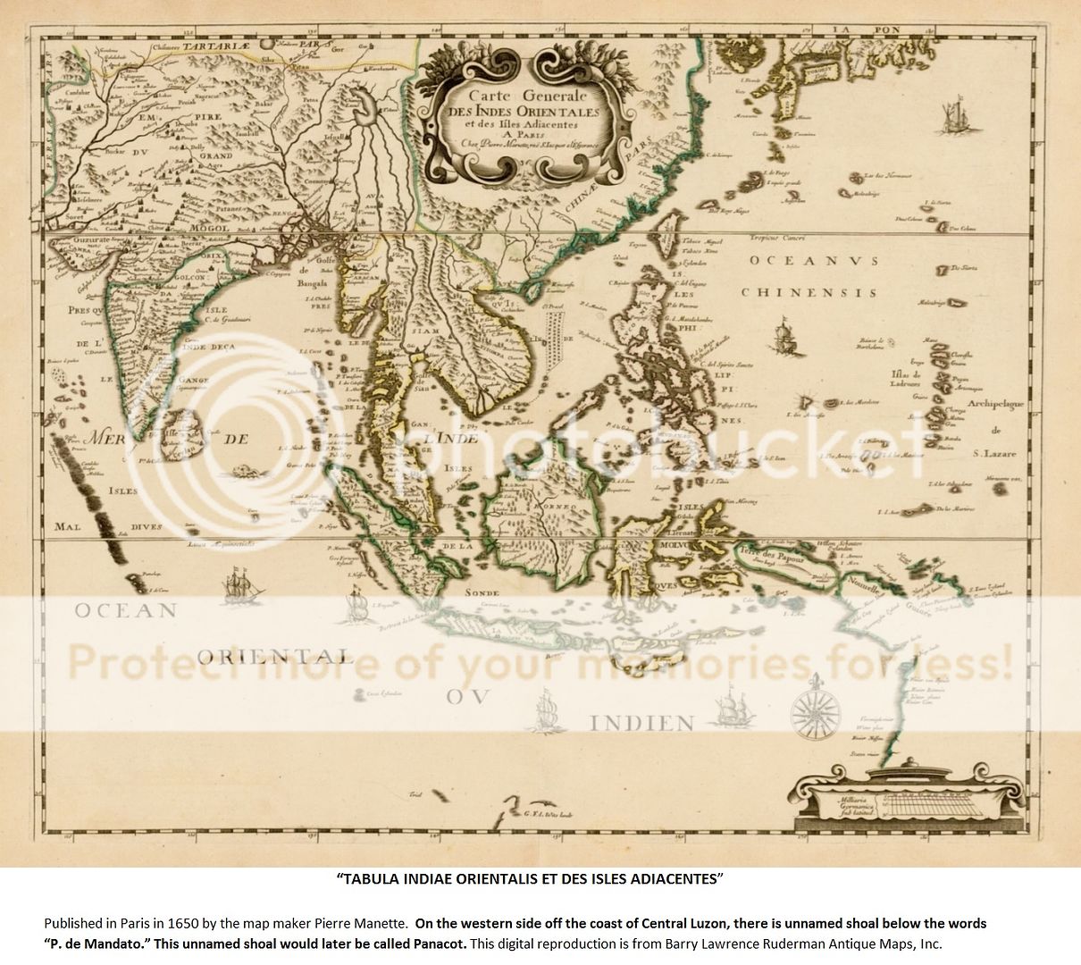
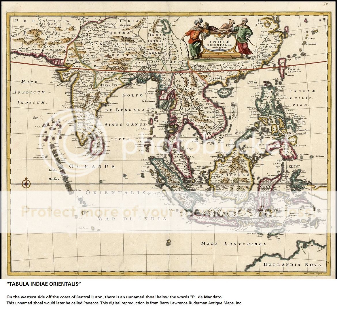
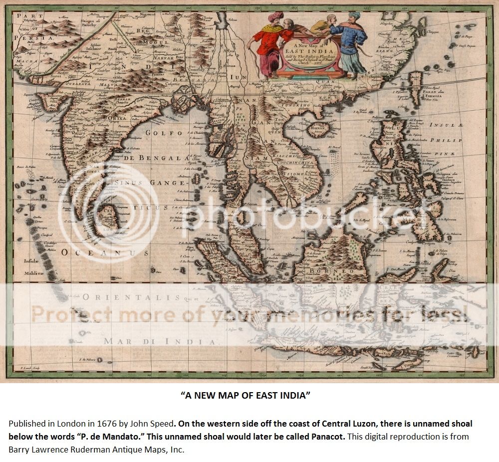
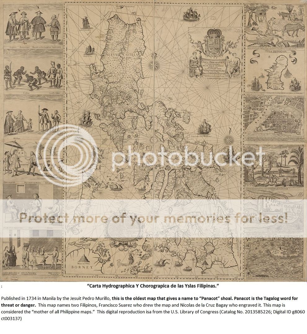
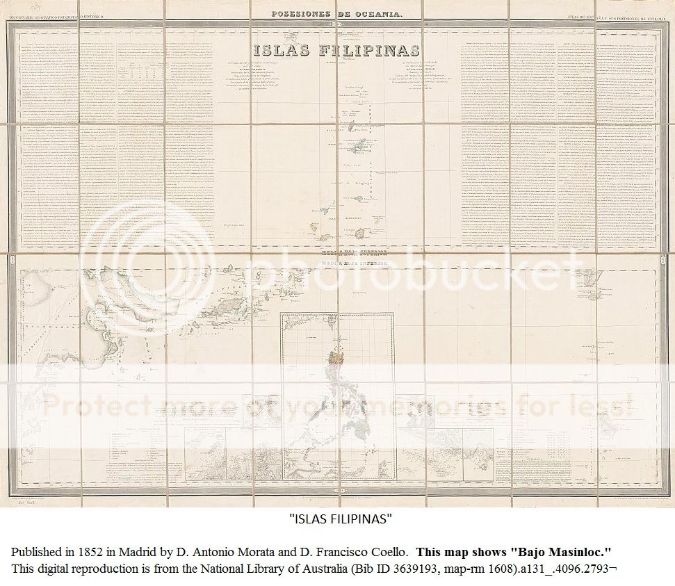
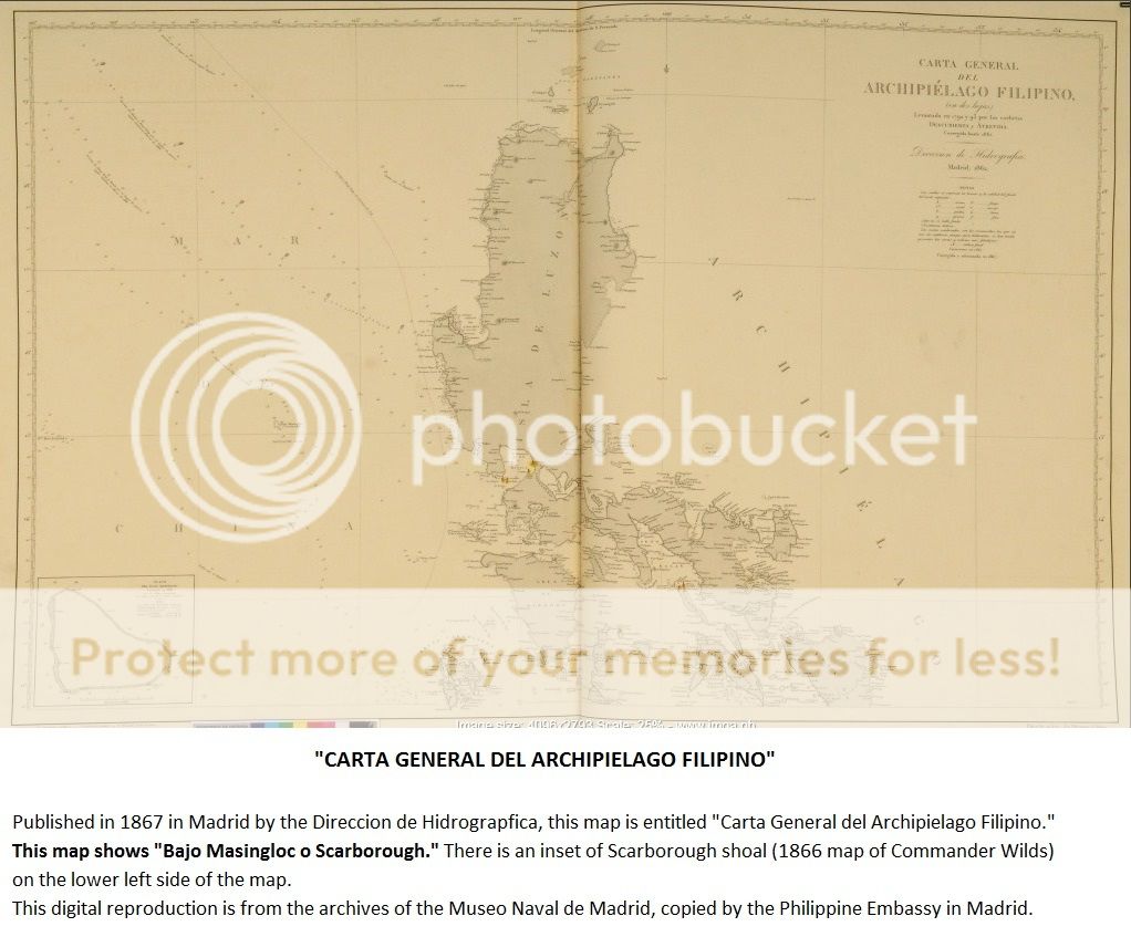
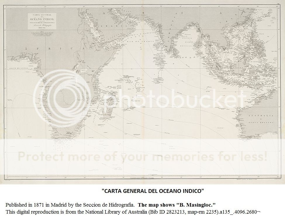
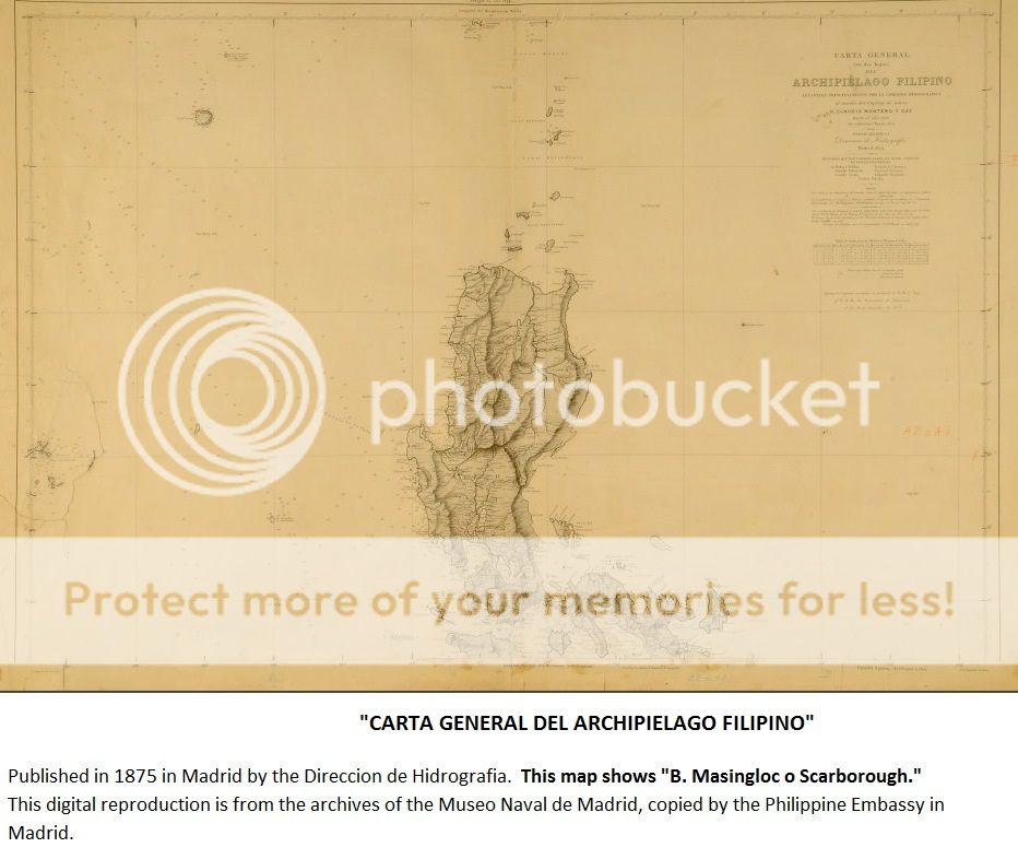
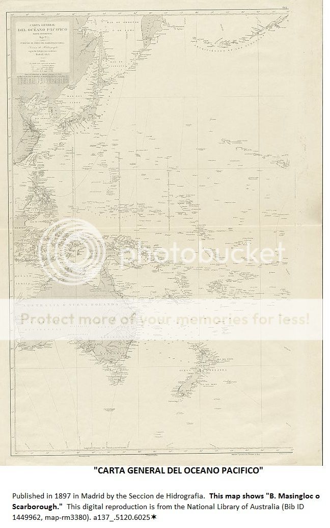
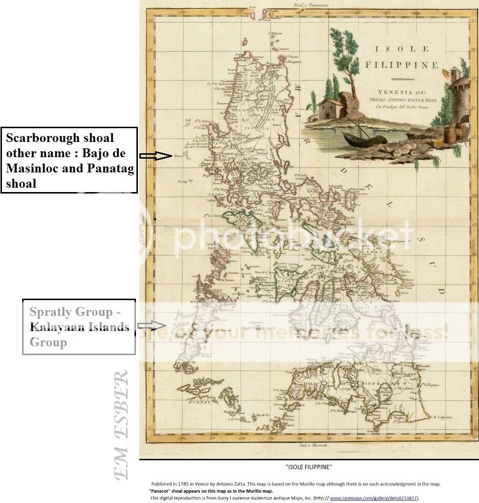
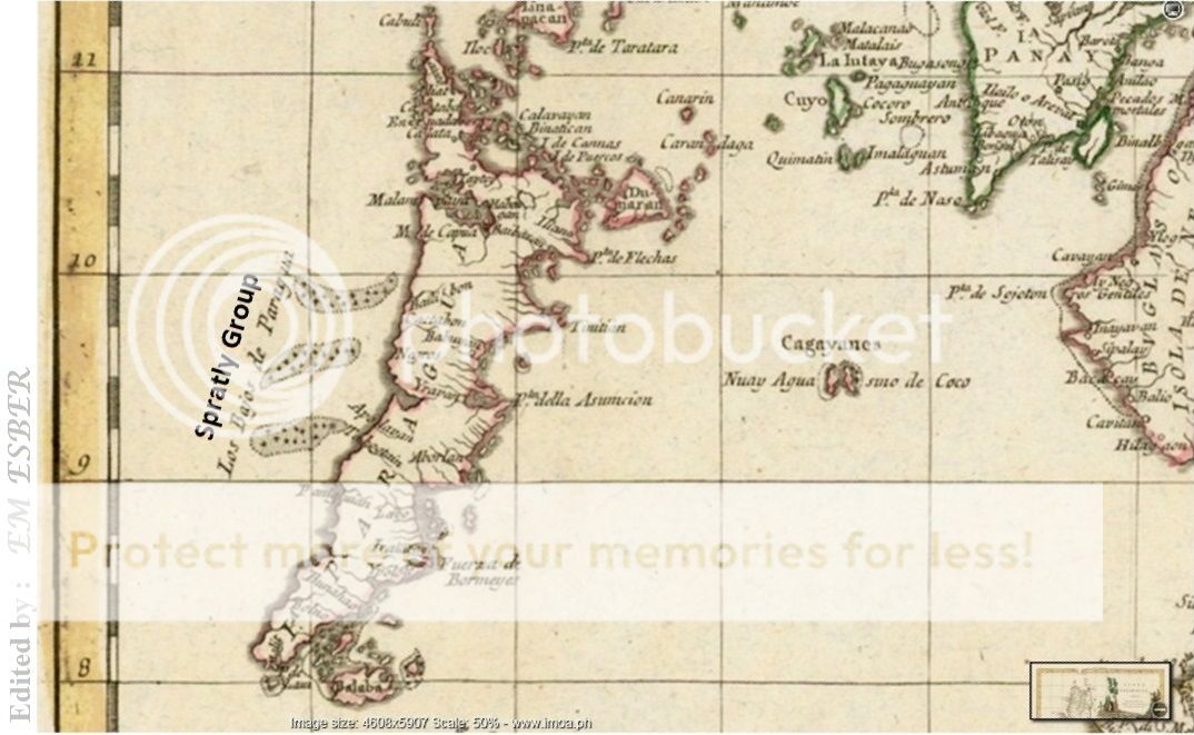
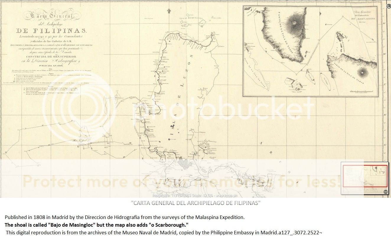
Spanish and other foreign maps showing either P. de Mandato, or Panacot shoal,
or Bajo de Masinloc which is the other name for Scarborough shoal.


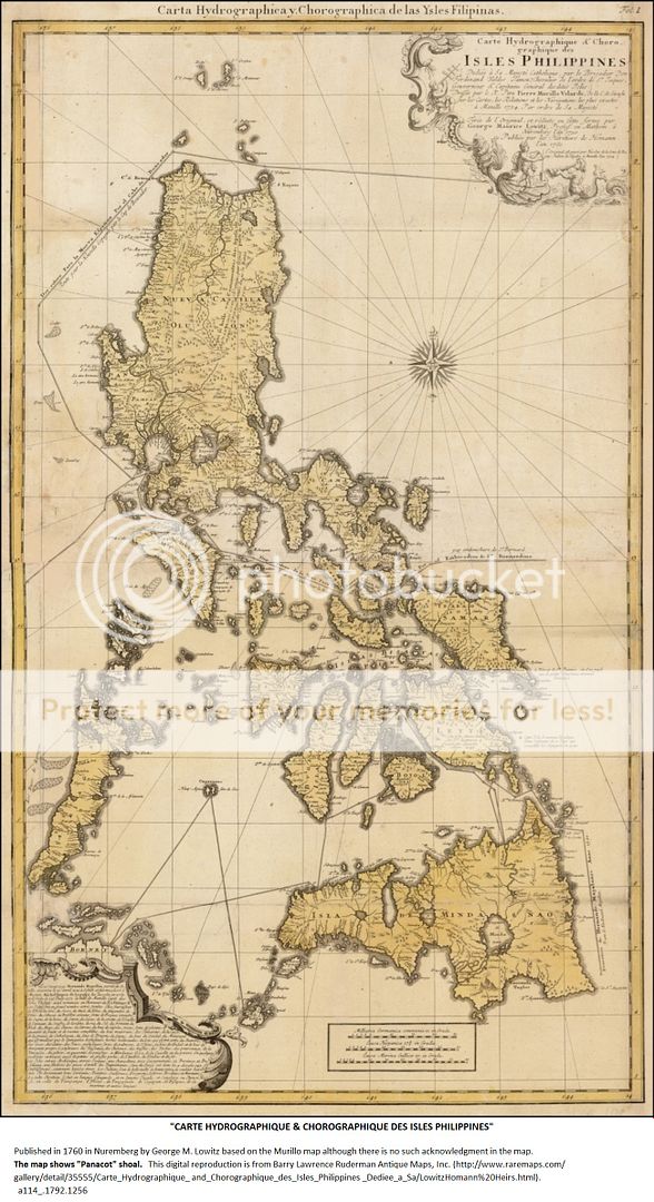


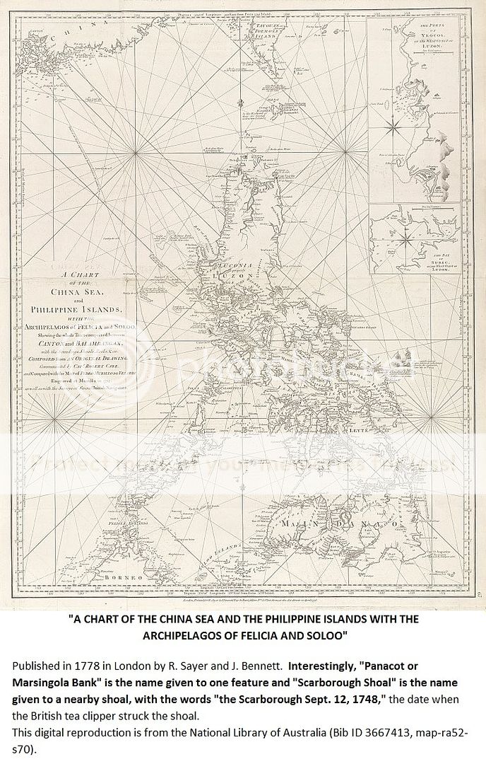
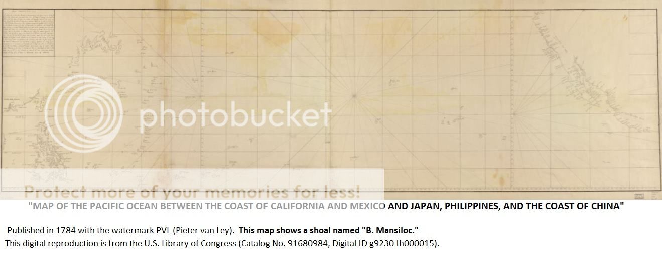


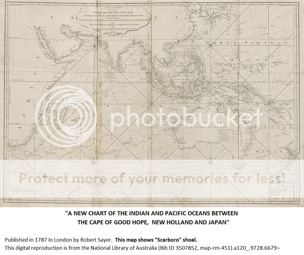


The Malaspina Expedition 1789–1794 http://www.ashgate.com/isbn/9780904180817


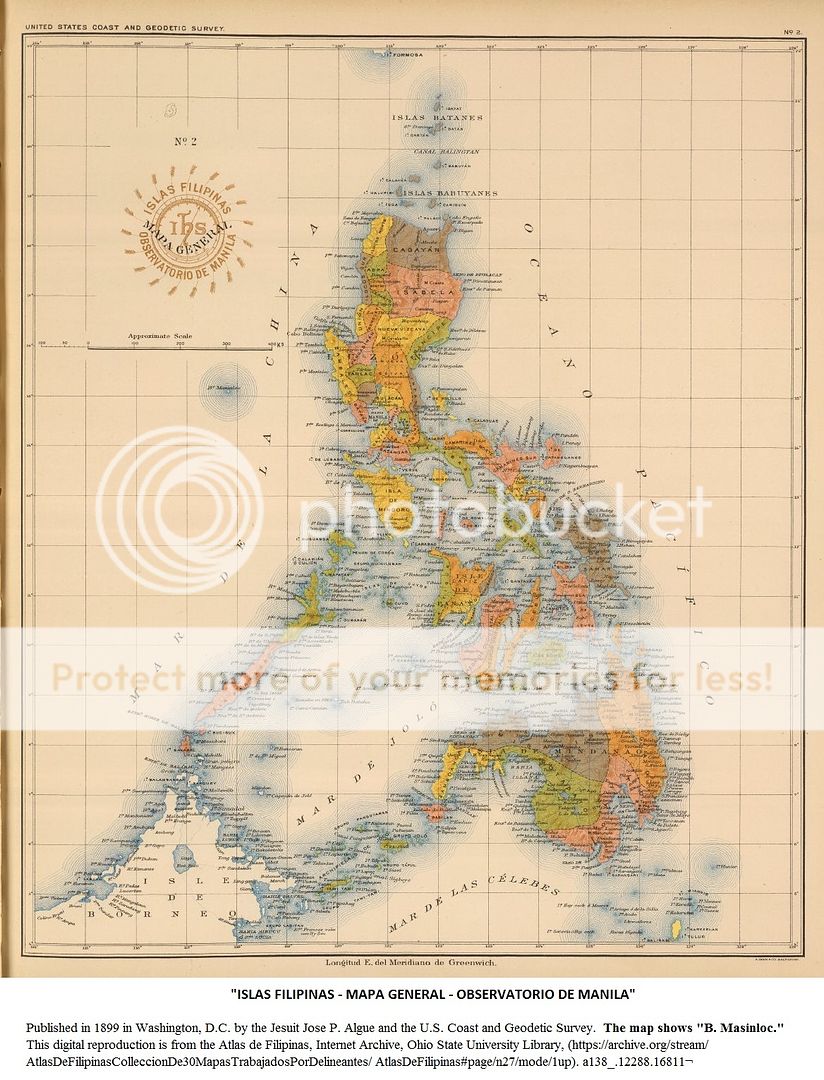

"ISLAS
FILIPINAS - MAPA GENERAL - OBSERVATORIO DE MANILA"
Published
in 1899 in Washington, D.C. by the Jesuit Jose P. Algue and the U.S. Coast and
Geodetic Survey. The map shows "B. Masinloc."

* * * * * *
Edited Spanish maps pointing to Scarborough and Spratly.


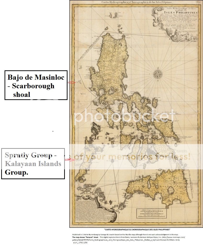
Malaspinas Expedition
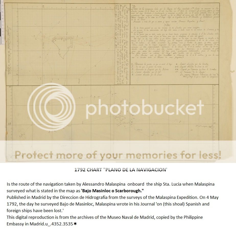

The Malaspina Expedition 1789–1794 http://www.ashgate.com/isbn/9780904180817


* * * * * *
Present era Maps of the Philippines


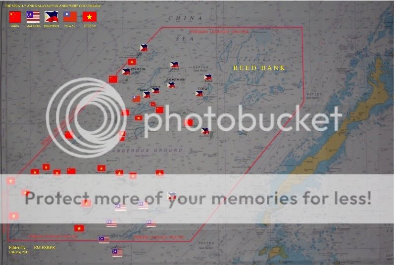
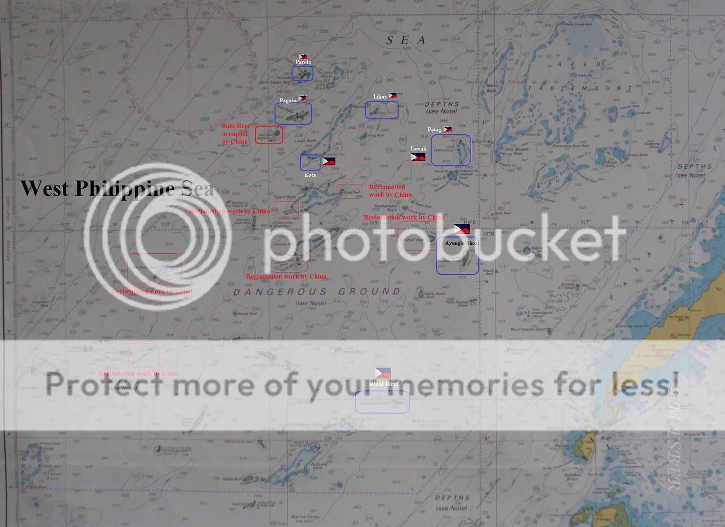 Philippine held islands in Kalayaan Islands Group.
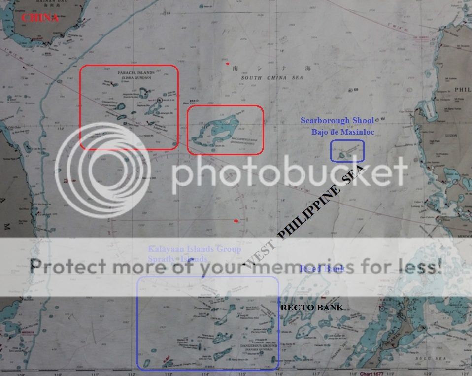
 Bajo de Masinloc - Scarborough shoal to Zambales coast.
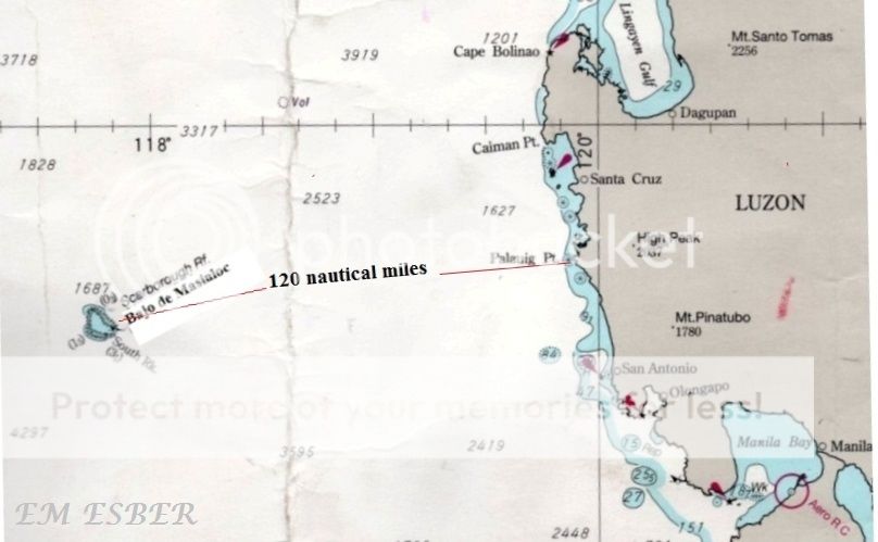
 Bajo de Masinloc - Scarborough shoal


* * * * * * *


Present era Maps of the Philippines
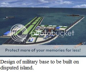
If our Bajo de Masinloc became a permanent PRC Chinese territory then they can reclaim even ten percent of the shoal and they can build a huge naval and military base that can threaten the security of our country.
Quoted from :
"On the matter of Bajo de Masinloc/Scarborough Shoal, it must not be allowed by Manila to turn into a dagger pointing at the throat of the Philippines given its proximity to its centers of gravity in Luzon such as the capital city, airports and ports in the National Capital Region and Central Luzon. Any military officer versed in military affairs would find that easy to discern not unless he specialized in business administration.
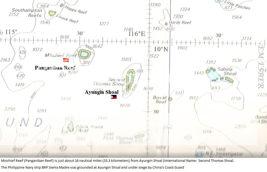
Eventually Manila must muster the political will and courage to steam back to that shoal and face off once again with the Chinese and frustrate what they are doing there. What China is doing to the Philippines at Ayungin must be done by Manila to the Chinese at Bajo de Masinloc. China will not withdraw there even if there is a favorable ruling for the Philippines from the international tribunal on the arbitration case.
Pls read more below :
Securing the Shoals - What must be done ?
http://www.interaksyon.com/article/67903/securing-the-shoals--what-must-be-done
* * * * * * *
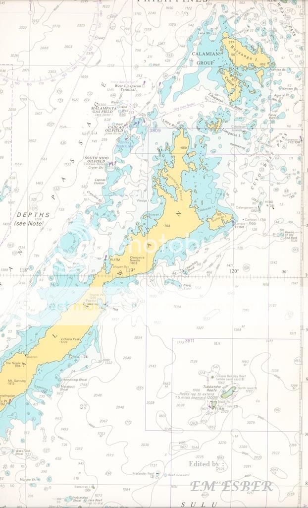
Our Malampaya Oilfield on the coast of Palawan
Our Malampaya Oilfields off the coast of Palawan.
* * * * * * *
Related story :
Top
Philippine judge uses Chinese maps vs China
Historical
Truths and Lies
SCARBOROUGH
SHOAL
Long history
of PH management
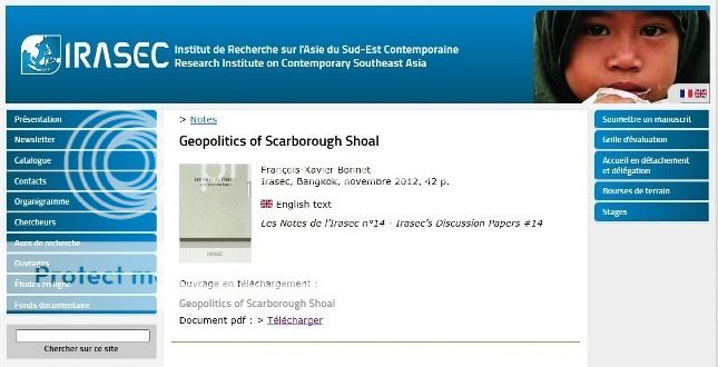
IRASEC –
Geopolitics of Scarborough Shoal
Download
Justice Antonio T. Carpio’s Presentation on West Philippine Sea Dispute (South
China Sea Dispute)
http://www.iss.nl/fileadmin/ASSETS/iss/Documents/News___events_docs/SouthChinaSea_Dispute_May2015.pdf
Three
Centuries of Philippine Maps 1598 to present era.
http://jibraelangel2blog.blogspot.com/2015/11/three-centuries-of-philippine-maps-1598.html
West
Philippine Sea Arbitration - Philippines won in First round
We must
recover our Scarborough Shoal from China's illegal occupation.
China
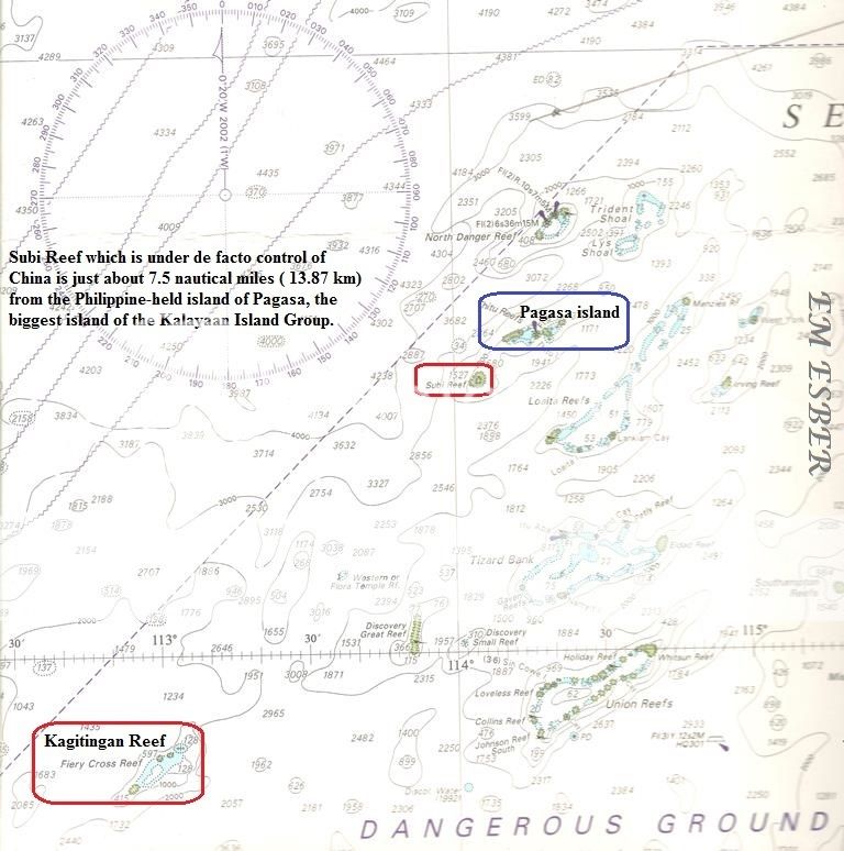
constructing Artificial Islands in some reefs of our Kalayaan Islands Group in
West Philippine Sea.
BRP Sierra
Madre at Ayungin Shoal - Philippine's Last Line of Defense Against China's
Agression
* * * * * *
No comments:
Post a Comment