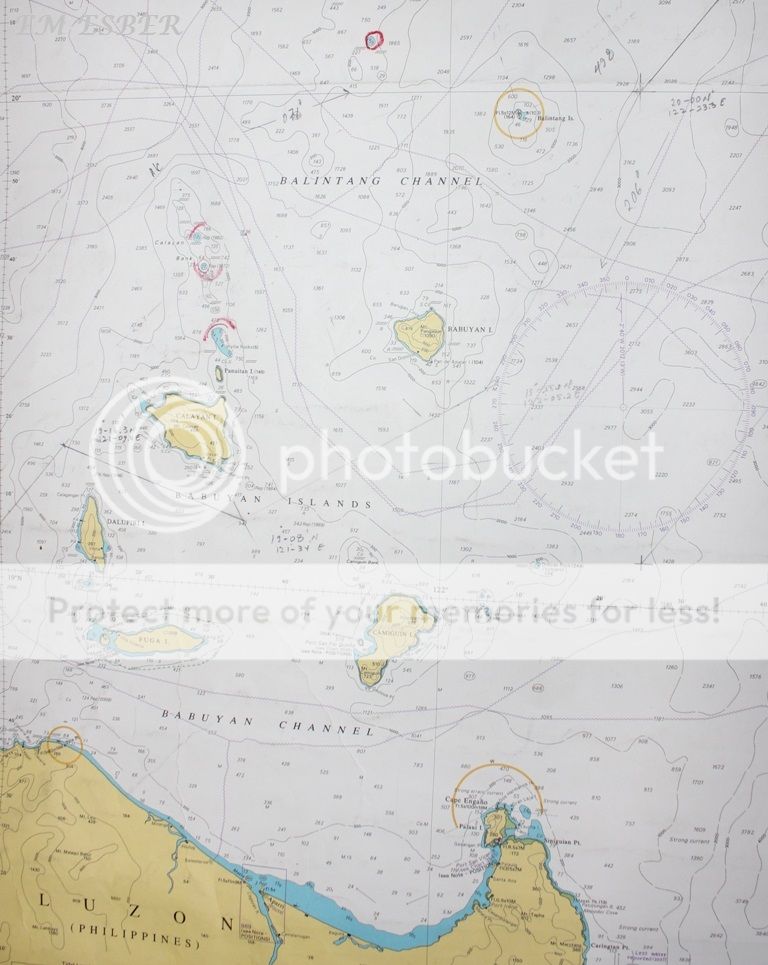
Balintang Islands
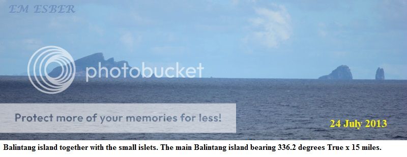
Balintang Islands are a smal group of rocky islands in the middle of Balintang Channel, in Luzon Strait northern Philippines. The islands are almost equidistant to both Babuyan Island, Cagayan, which lies about 29 miles (47Km) to the southwest, and Sabtang Island, Batanes, located 28 miles (45 km) to the northwest. The group is composed of seven small, sharp-peaked islets and rocks visible about 24 miles (3 km) in clear weather.
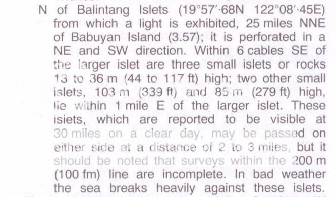
The westernmost island, Balintang Island, is the largest with about 3⁄4 miles (1.2 km) in length in a north and south direction. It is much larger than the others with three peaks, the tallest of which is about 360 feet (110 m); a hole is seen through it from southwestward. Three of the other islets lies east, about 1 mile (1.6 km) off its northern point. The other three, about 75 feet (23 m) high, lies about 1⁄2 miles (0.80 km) off its southeast side. In bad weather, the sea breaks heavily against them. For mariners, they are steep-to and may be passed on either side at a distance of 2 to 3 miles (3.2 to 4.8 km).
http://en.wikipedia.org/wiki/Balintang_Island


* * * * * * * * * * * * * * * * *
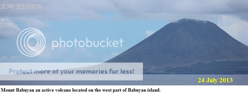
Babuyan Island
The Babuyan Islands consist of five major islands - Babuyan Island, Calayan, Camiguin, Dalupiri, and Fuga Islands - and their adjoining islets.
The eastern islands of the archipelago are part of the Luzon Volcanic Arc. Three volcanoes from two of the islands have erupted in historical times - Camiguin de Babuyanes on Camiguin Island, Babuyan Claro and Smith Volcano on Babuyan Island. Another small volcanic island located just 14 miles (22km) NE of Camiguin Island, Didicas Volcano on Didicas Island, became a permanent island only during the activity of 1952.
The Babuyan Islands are part of the province of Cagayan. Four of the islands - Babuyan Claro, Calayan, Camiguin and Dalupiri - belong to the municipality of Calayan. Fuga Island is one of the barangays of Aparri.
http://en.wikipedia.org/wiki/Babuyan_Islands


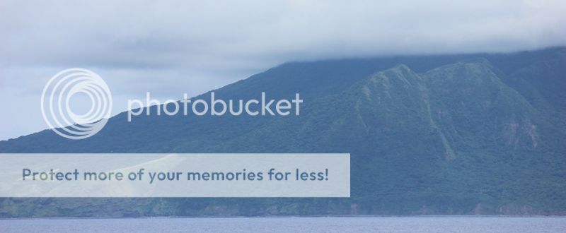
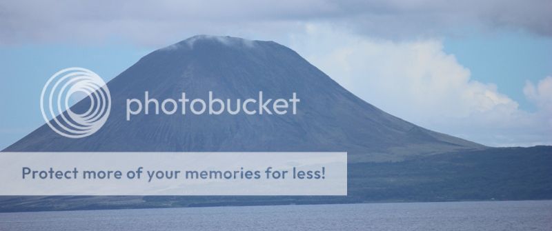
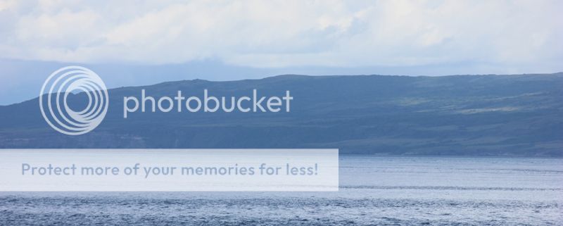
View of the east side of Babuyan Island.


* * * * * * * * * * *
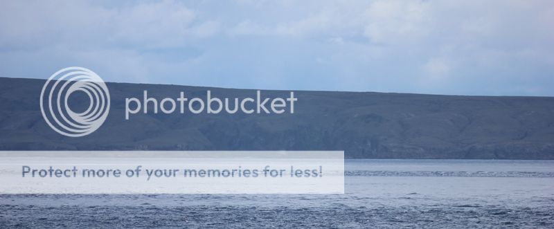
View of the southeast coast of Babuyan Island


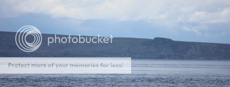
View of the southcoast of Babuyan Island and the main town of San Dionisio.


Calayan Island
Calayan (Ibanag language, meaning "full of ginger") is a 3rd class municipality in the province of Cagayan, Philippines. According to the 2010 census, it has a population of 16,200 people in an area of 49, 453 hectares.
Calayan is located in Luzon Strait north of Luzon Island. The municipality of Calayan is composed of four of the five major islands of the Babuyan Islands namely: Calayan, Camiguin, Dalupiri and Babuyan Island. Calayan Island is the largest of the Babuyan Islands, Fuga Island, the fith island within the Babuyan Islands, is part of Aparri municipality. Calayan is home to the Calayan Rail, a flightless bird identified as a separate species identified as a separate species in 2004 and endemic to Calayan Island.
History
A mission headquarters was established on Calayan Island in 1722. During the Spanish colonial administration regime, the administrators were Don Licerio Duerme in 1896, Don Pedro Abad in 1897, and Don Angel Escalante during 1898-1902.
Administratively, the Calayan island was part of the Batanes group of islands. From 1902, Calayan was brought under Cagayan Province. However, this change of administrative control resulted in isolation of the islanders as transport communications were lacking. In 1916, Fray Andres Sanchez and Fray Geronimo Morer, Dominican Fathers, visited this island and when they heard the meaning of "Calayan", and also smelled the strong scent of ginger, they gave this name to this Island. It was only in 1954 that the Governor of Cagayan, Jose P. Carag, came to Calayan. The next visit by a governor was only in 1981, by Justiniano P. Cortez, when a mobile government was organized to improve the health conditions of the people and to distribute medicines and food items such as rice, canned goods, and seeds. A repeat of this mission occurred in 1982.
On 11 January 1940, during World War II, American Forces, who came by the USS Princeton, occupied the island.This was welcomed by the people of Calayan as it ushered prosperity to the island. Medicines, clothing and many other items of utility were distributed to the islanders by the American soldiers. The Calayanos showed their gratitude by way of offering gifts to the soldiers such as ancient Chinese jars, sea shells and many handcrafts. Schools were established by the American forces and they also functioned as teachers with English as the medium of instruction. They also introduced adult education programmes.
During World War II, the Calayan group of islands were occupied by the Japanese Imperial Forces on 8 December 1941. This resulted in disturbance to the quality of life for the islanders, as many of the development works implemented by the Americans were destroyed. This trend, however, changed in early 1944 when the American Forces reoccupied the islands as part of war of liberation and imprisoned the Japanese prisoners and moved them to camps in Luzon.
The rocky northern coast line of the Calayan Island was the scene of a disaster when the war ship Datu Kalantiaw, which had served during the World War II and subsequently under the Philippine flag, was hit by Typhoon Clara. The ship ran aground on 21 September 1981. Rescue and recovery operations were launched by the ammunition ship Mount Hood (AE-29) together with the Philippine Navy units "in a most adverse weather environment," and could recover only 49 bodies of the 97 crew members on the ship (other bodies were not found) and were taken to Manila to be handed over to the next of kin of the dead.
Calayan experienced an earthquake shock of 5.1 magnitude on 23 December 2012. Its epicenter was located at 42 kilometres (26 mi) to the west of Calayan at a depth of 16 kilometres (9.9 mi), and no damage or deaths were reported.
Geography
Calayan Island is located about 24 miles (39 km) west-southwest of Babuyan Island off the north coast of the Philippines and belongs to the Babuyan Island group in the China Sea. The island is hemmed between Aparri and Batanes islands and it is larger than the Fuga Island, which is 25 miles (40 km) away. It is the second district in the province of Cagayan and its 29th municipality. It has rocky shores and the beaches have white sand. The land area of the island is 494.53 square kilometres (190.94 sq mi). It has a rough rectangular shape with rolling hills, spread over a length of 23 kilometres (14 mi). The island consists mainly of mountainous and uneven land, with the highest land in the centre, with low gaps in places. The hill ridge runs through the middle of the island and is heavily forested. The Mt. Calayan which was once an active volcano is the highest peak here. The island is of volcanic origin and has rich deposits of perlite, a greyish white rock which is called as the "wonder rock".
The populated areas on the island are Calayan town (Centro) and Magsidel on the south coast. Calayan town is the largest among the Babuyan Island group and it is a small fishing center.
Four rivers drain the island. Coral limestones are seen at both the higher and lower levels of the island. The eastern part of the island has basaltic columns, which are seen in a good state of preservation. The present access is by outrigger boats locally called lampitaw, which takes the islanders from Calayan to the port of Aparri and Claveria on the west coast of the Cagayan Province where an airport to operate small aircraft is also under construction.
http://en.wikipedia.org/wiki/Calayan,_Cagayan
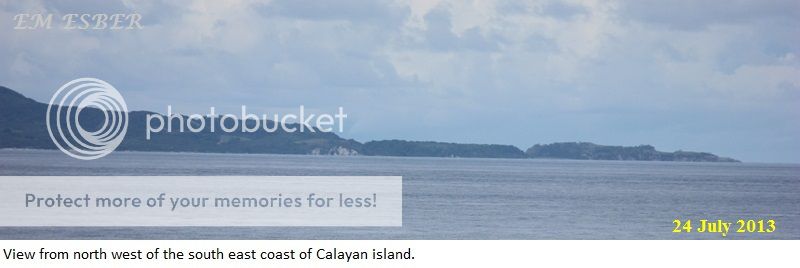
View of the east coast of Calayan Island


Panuitan Island located near the northeast coast of Calayan Island


View of the south coast of Calayan Island


View of Calayan Island from the vicinity of northwest part of Calayan Island


* * * * * * * * * * * * *
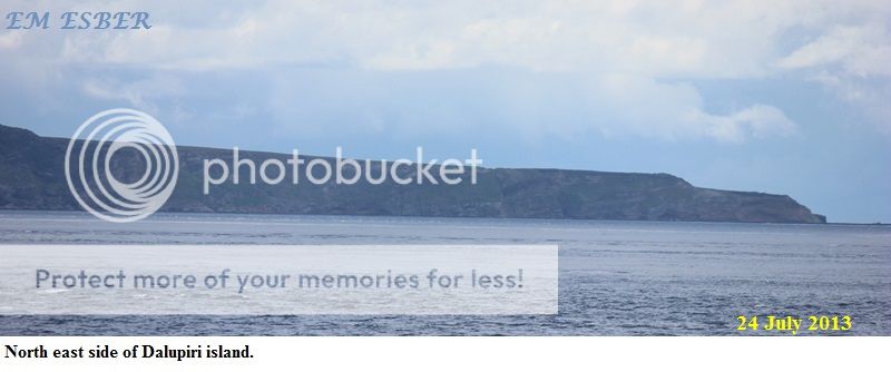
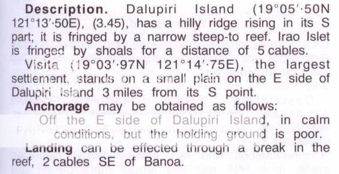
View of the east coast of Dalupiri Island


Fuga Island
Fuga Island is an island in the municipality of Aparri, Cagayan. With an area of 100 km², it constitutes one of 42 barangays of Aparri along with the neighbouring islets of Barit (4.8 km²) and Mabag (0.7 km²).
Though under the jurisdiction of mainland Aparri, it is part of the Babuyan Archipelago, the second-northernmost island group of the Philippines. The highest peak is Mount Nanguringan in the northeast, with an elevation of 191 meters.
According to the 2000 population census, it has 1,786 people in 312 households. The principal settlement is Naguilian (Musa) village on the southern coast.
The island still retains a traditional culture, a manifestation of which is the annual construction of a small straw imitation boat that is floated out to sea. The tradition began in 1656 when the island was almost invaded by British ships, prompting islanders to make a similar replica of a boat, thus preventing the island's annexation by Great Britain.


YOUTUBE VIDEO
View of Balintang Island, Babuyan Island, Calayan Island, and Dalupiri Island
Babuyan Island
Calayan Island
Dalupiri Island
Fuga Island
Related Blog :
Port San Pio Quinto – Camiguin Island de Babuyanes