


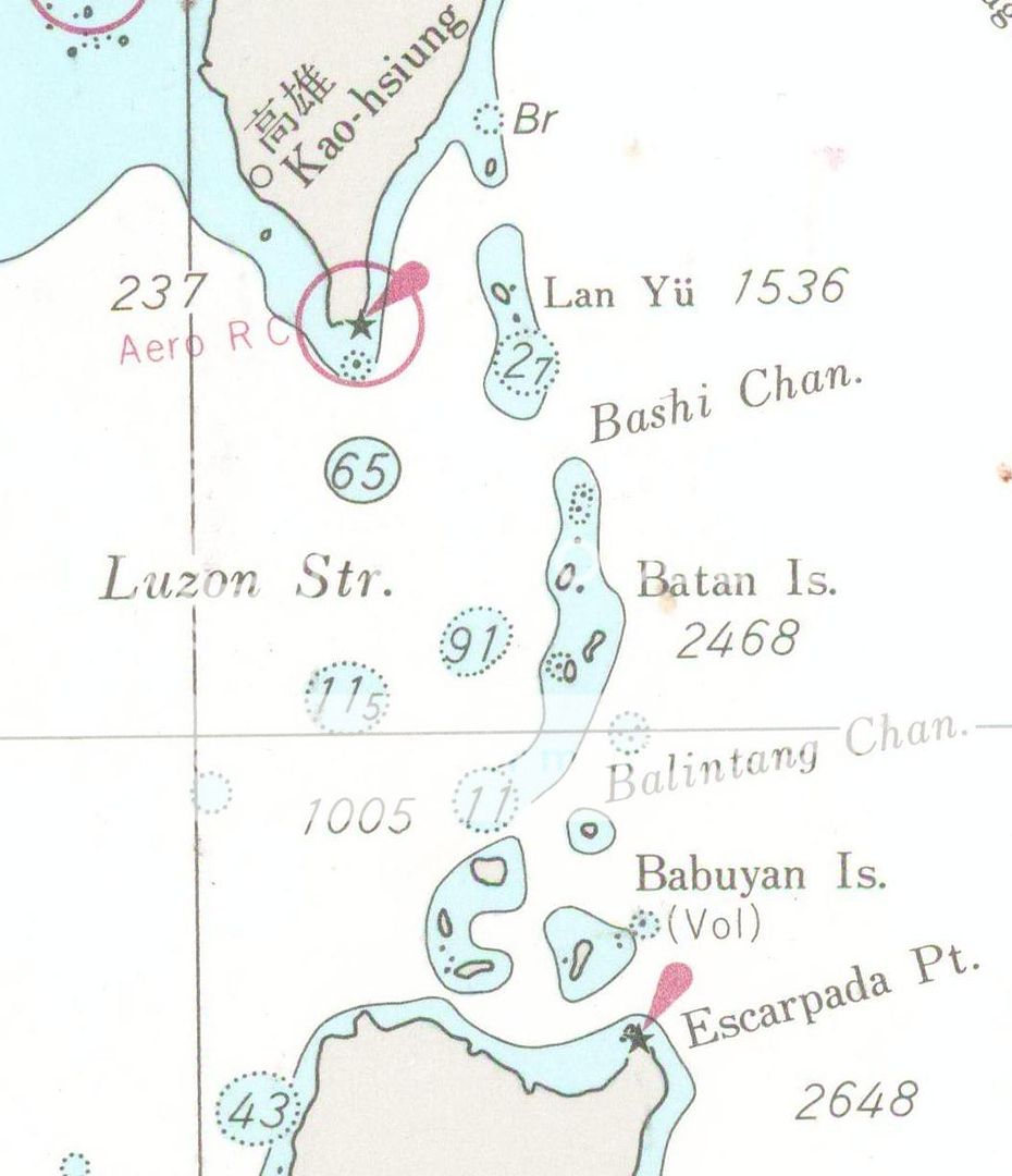
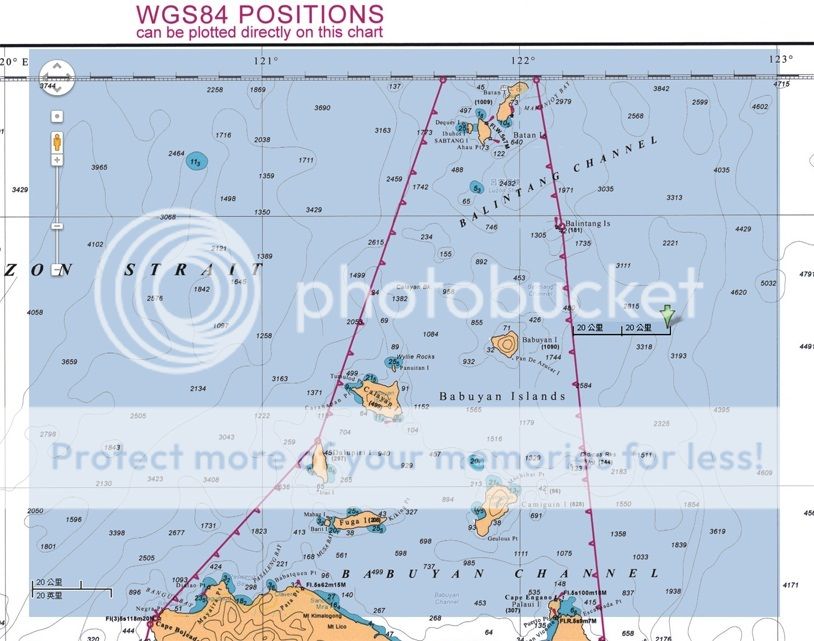
Philippine Baseline in northern Luzon and Batanes

Philippine Baseline in Luzon and Visayas, and Benham Rise Area.
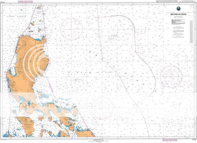
Philippine Baseline in Luzon and Visayas, and Benham Rise Area.

Proposed Archipelagic Sea Lanes for Foreign Vessels transiting the Philippine Archipelago
* * * * * *
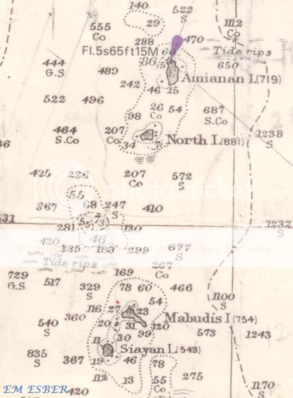
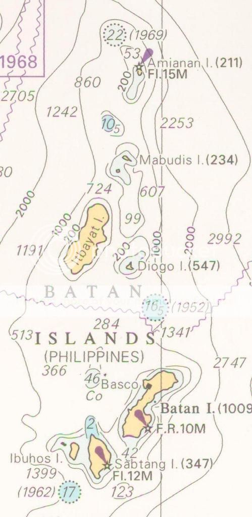
MARITIME CHARTS / MAPS OF BATANES AND NORTHERN LUZON

( Treaty of Peace between the United States and Spain
http://avalon.law.yale.edu/19th_century/sp1898.asp )
( Treaty of Washington in 1900 between the United States and Spain
http://www.gov.ph/1900/11/07/the-philippine-claim-to-a-portion-of-north-borneo-treaty-between-the-kingdom-spain-and-the-united-states-of-america-for-cession-of-outlying-islands-of-the-philippines-1900/ )


* * * * *
ZAMBALES COAST AND SUBIC BAY

Masinloc Zambales to Subic Bay
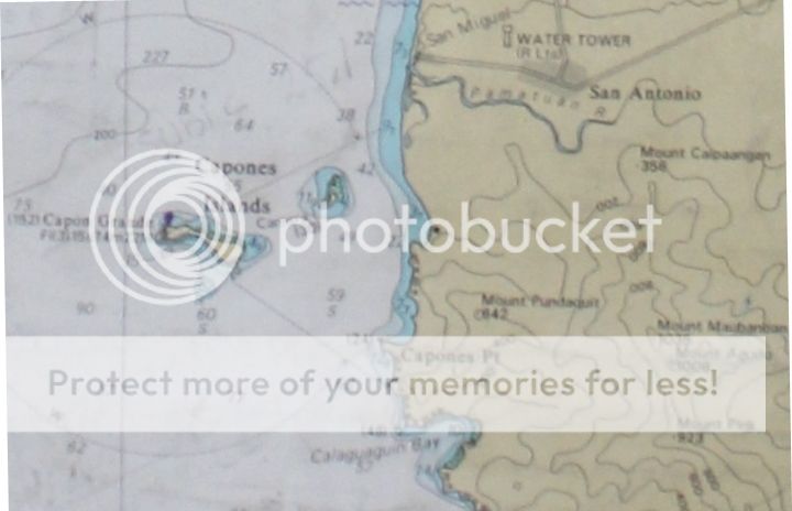
Capones Island off Zambales coast

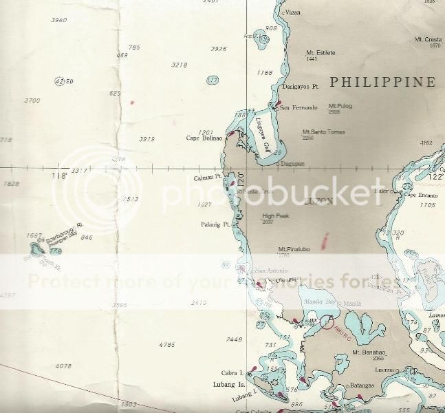
Masinloc to Subic Bay

Capones Island to Subic Bay

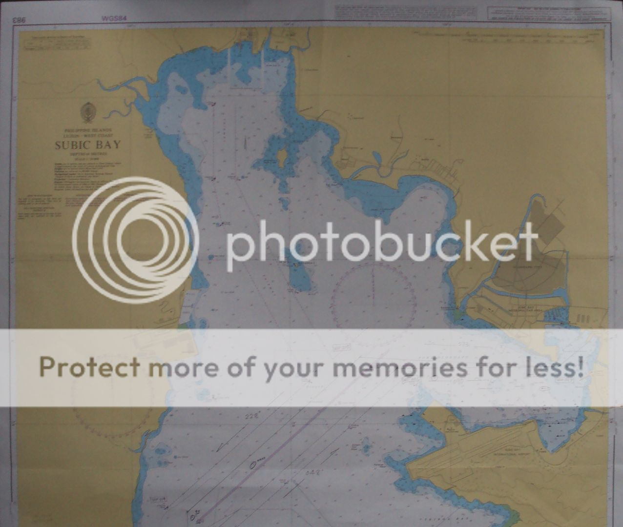
Subic Bay

Hanjin Shipyard located on the southwest part of Subic Bay near the entrance of the bay.

Hanjin to Grande Island
SBMA to Hanjin Shipyard

SBMA to Airport

SBMA and Olongapo

* * * * *
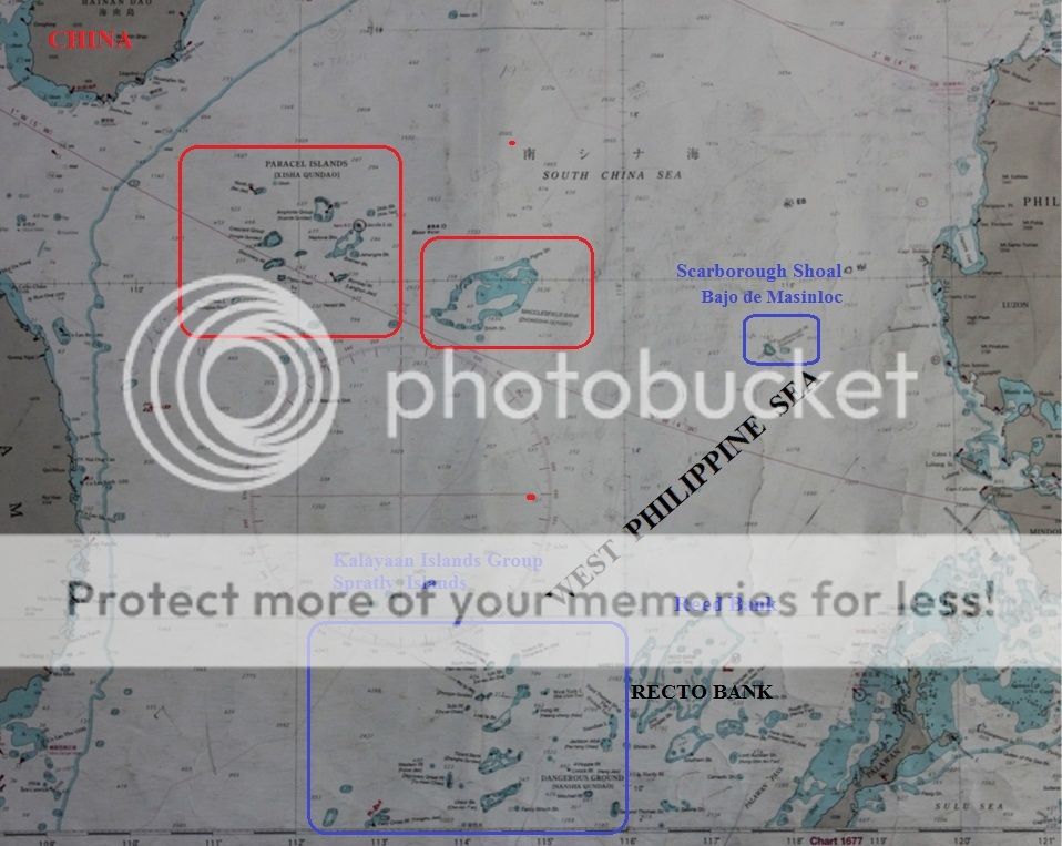
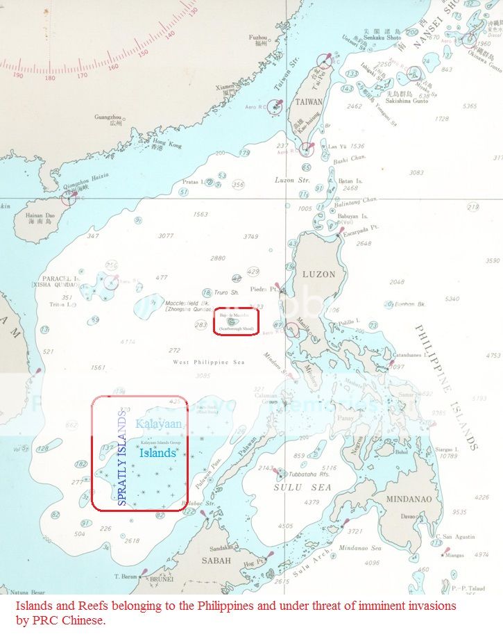
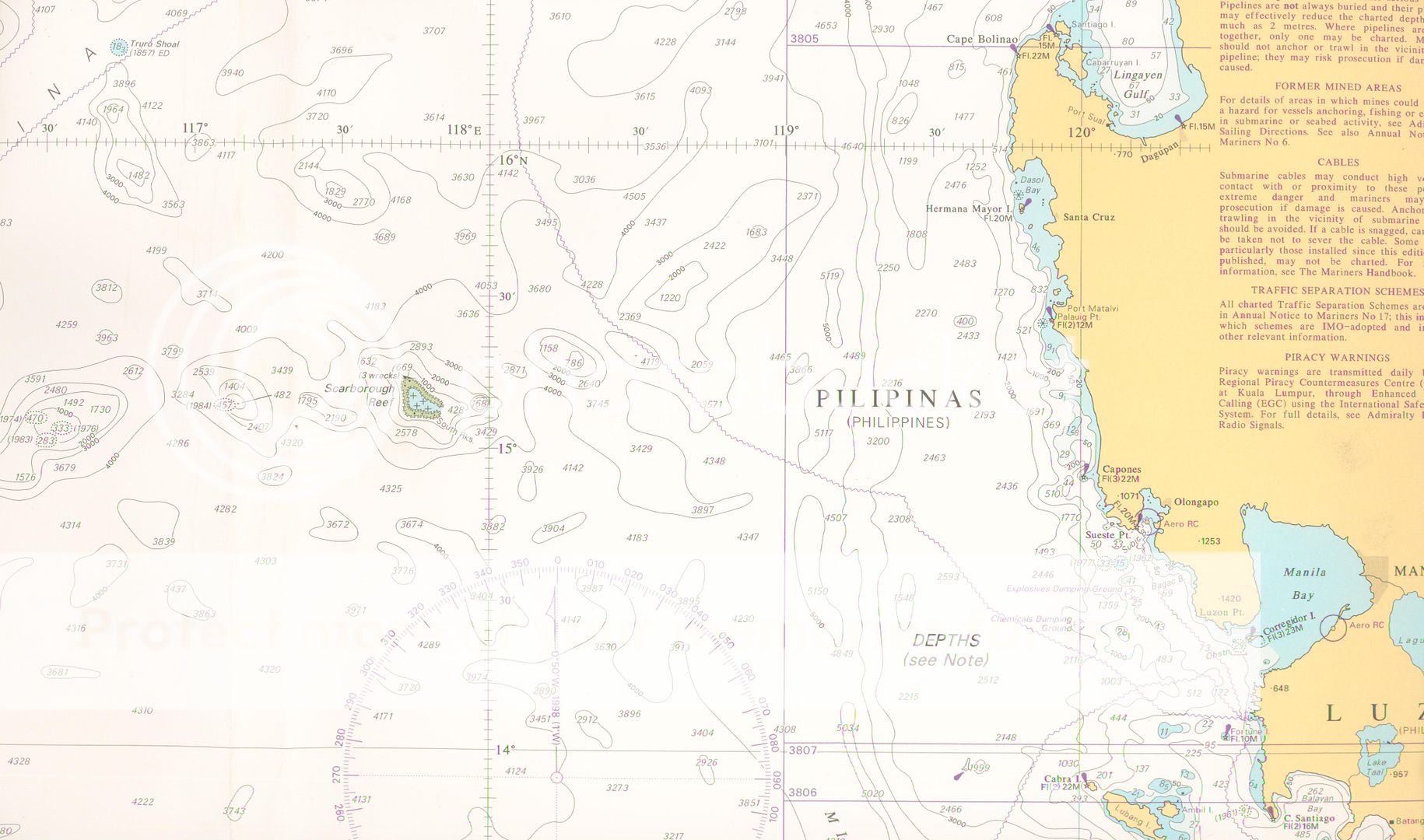
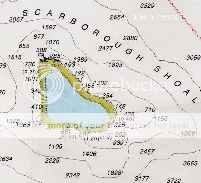
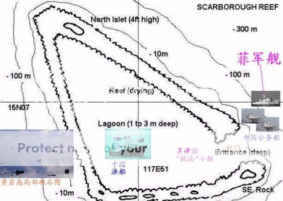
Bajo de Masinloc also known as Panatag Shoal and Scarborough Shoal


* * * * *
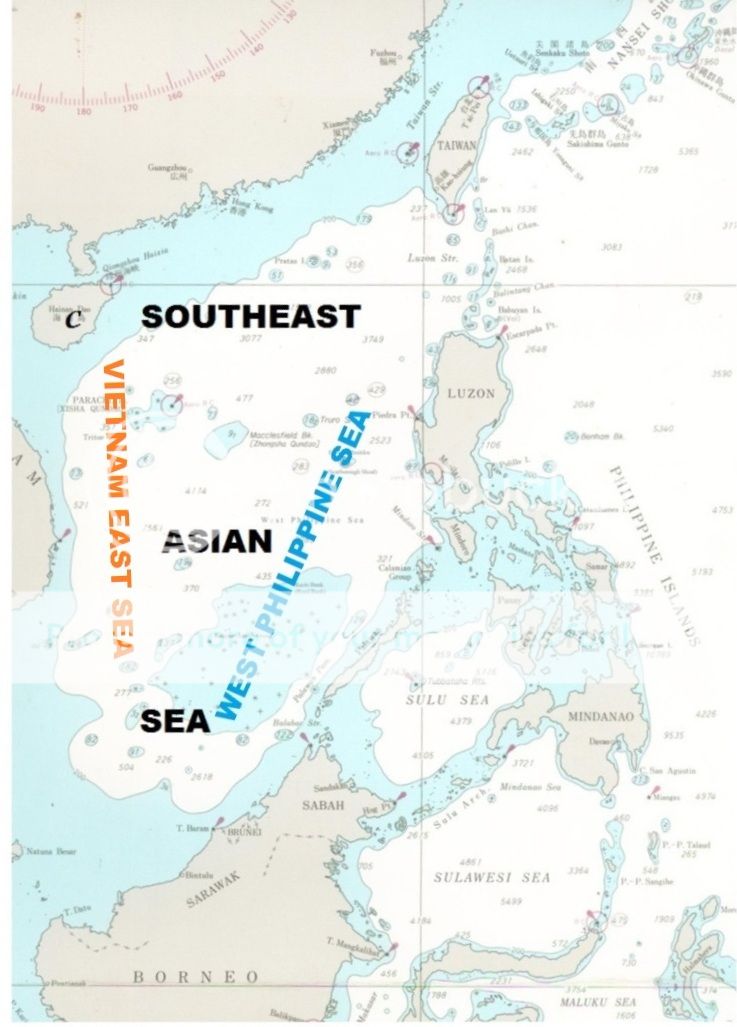
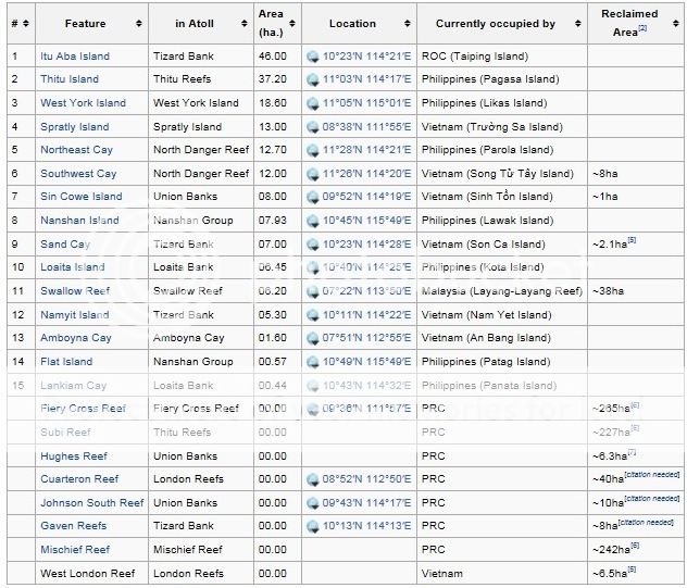
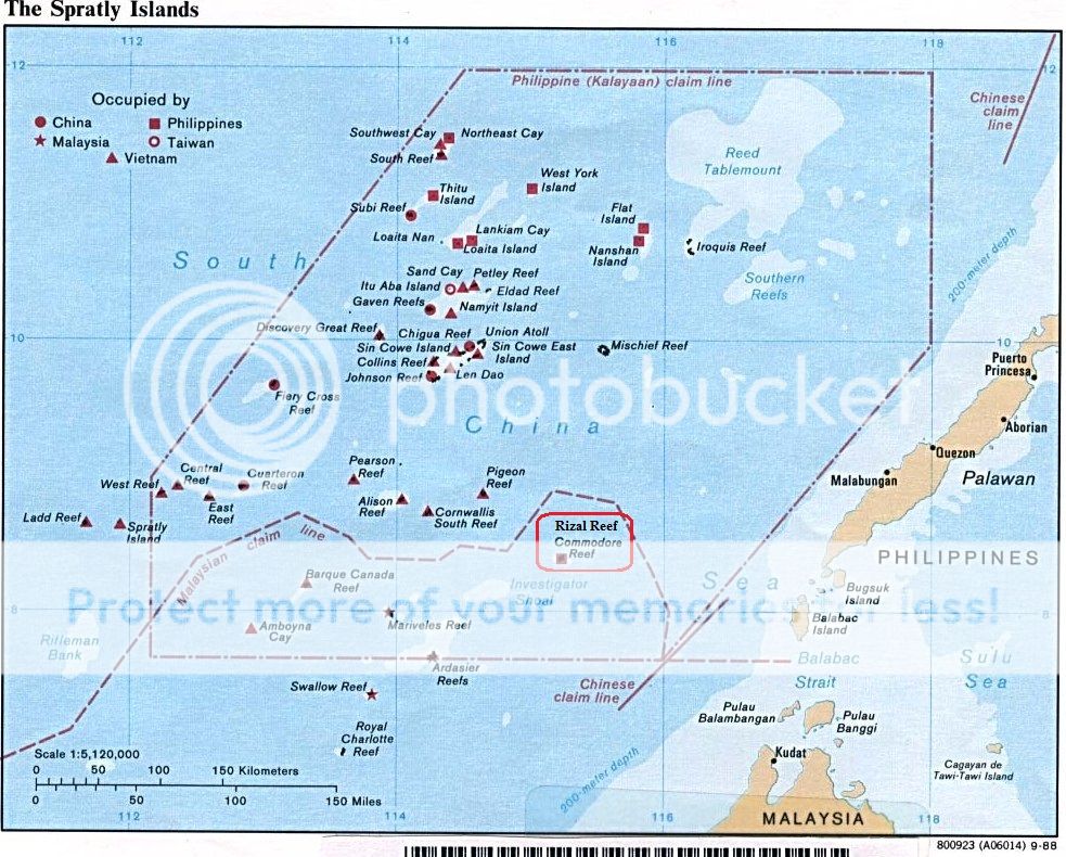
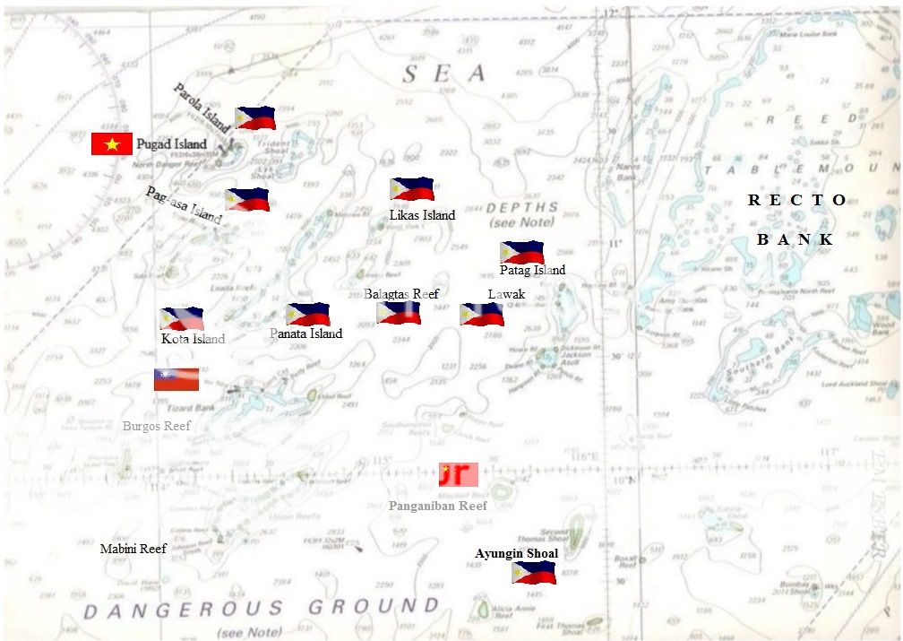
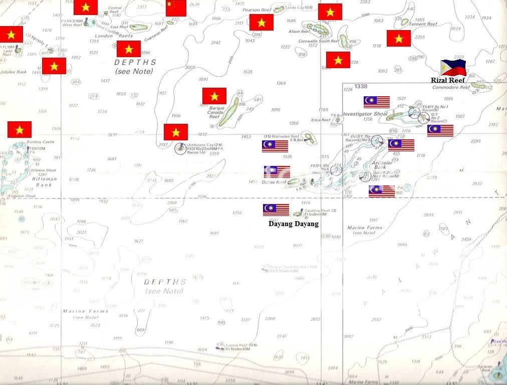
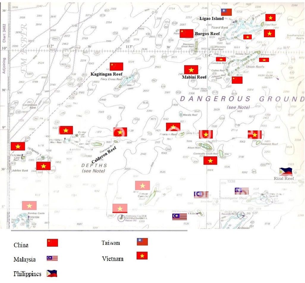
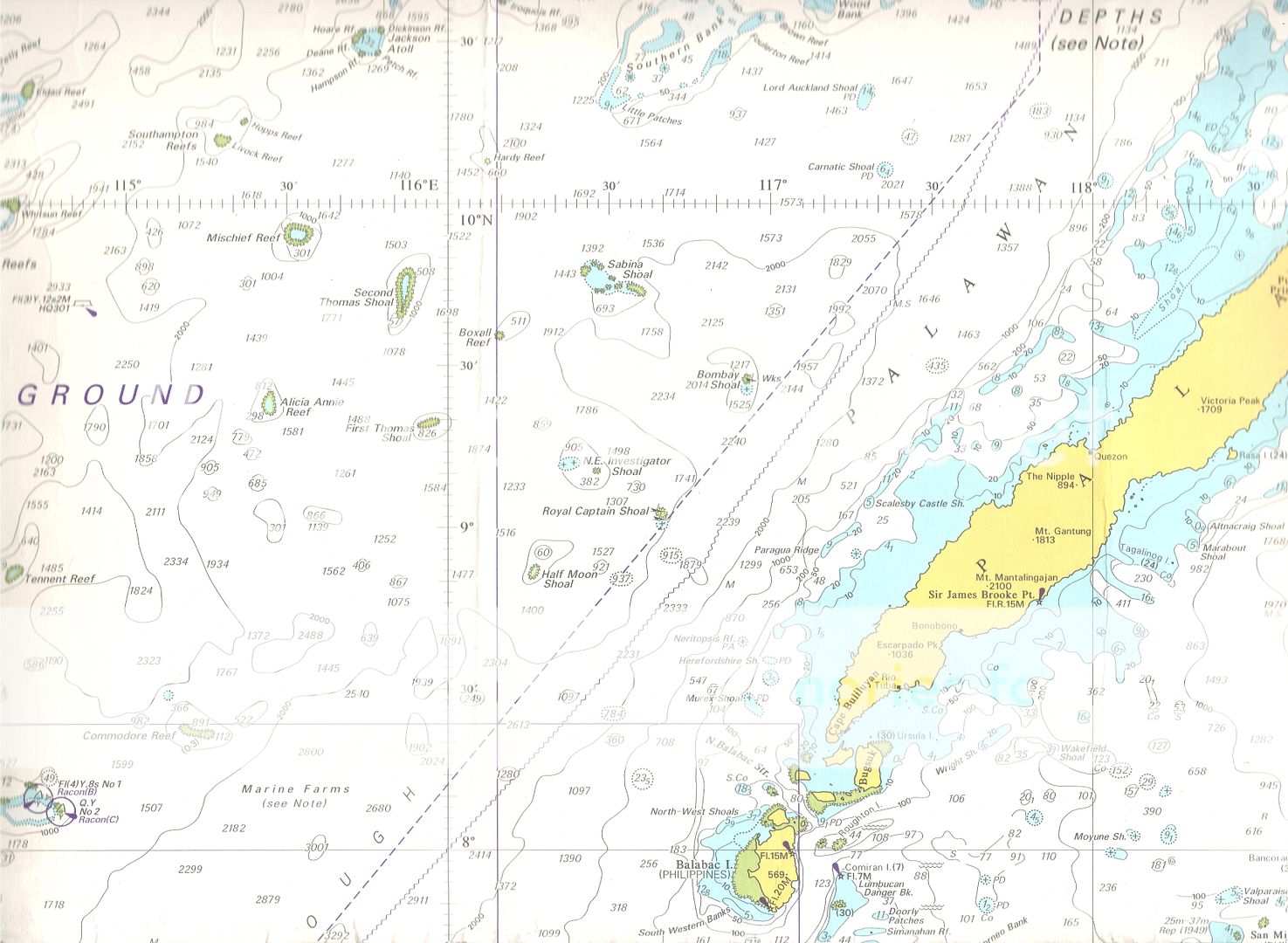
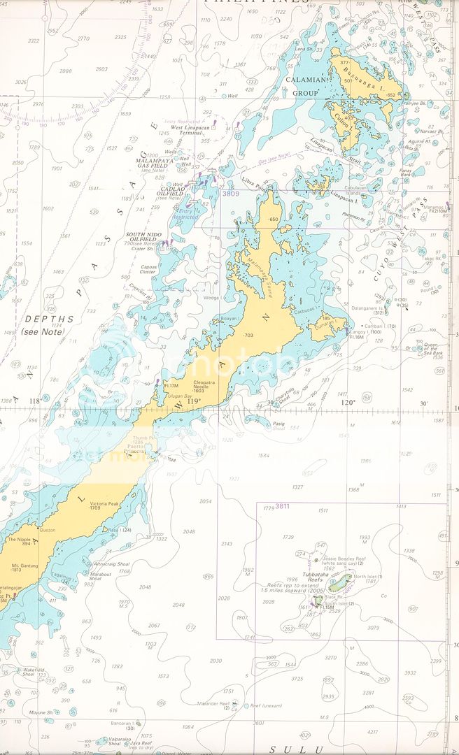
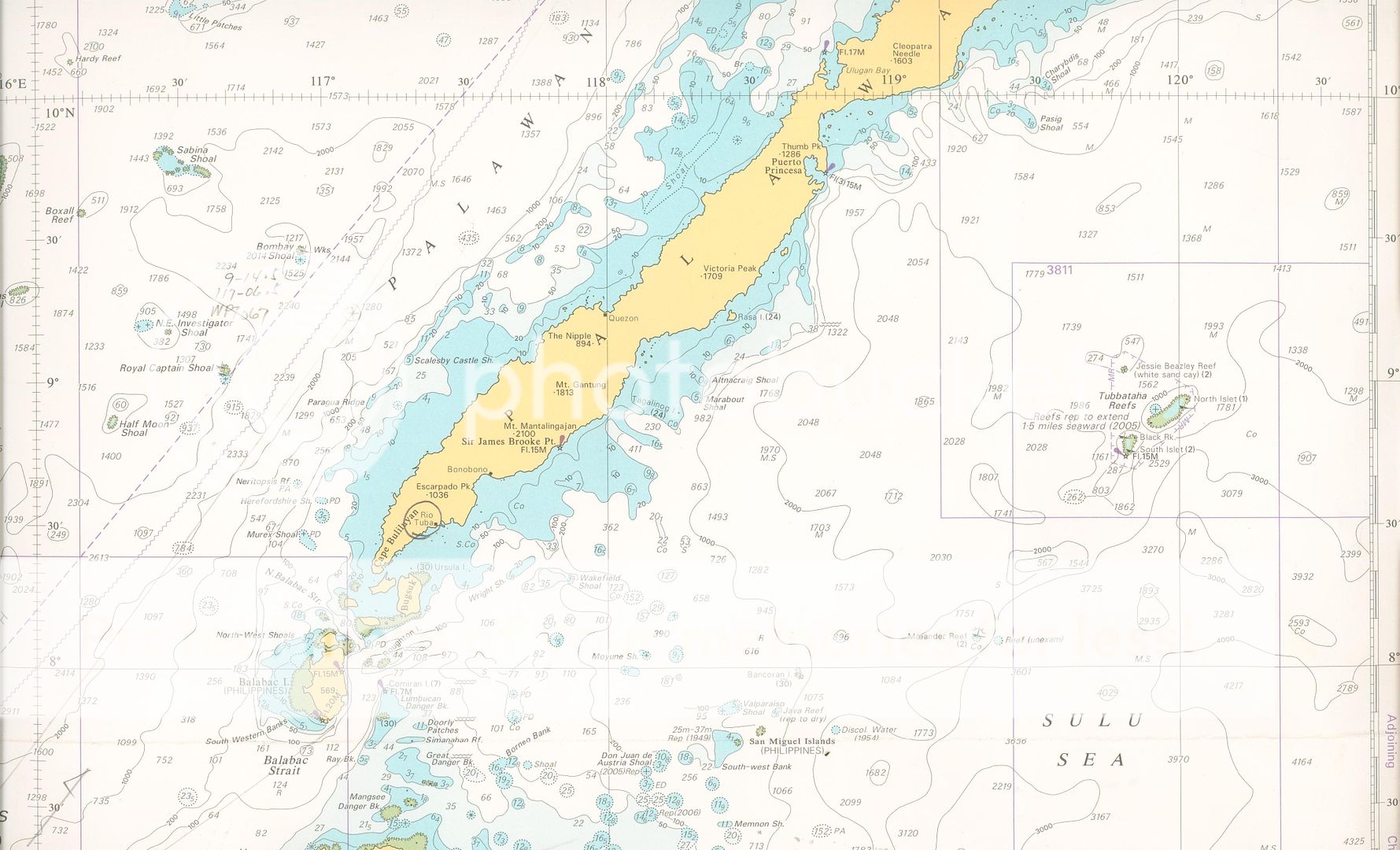
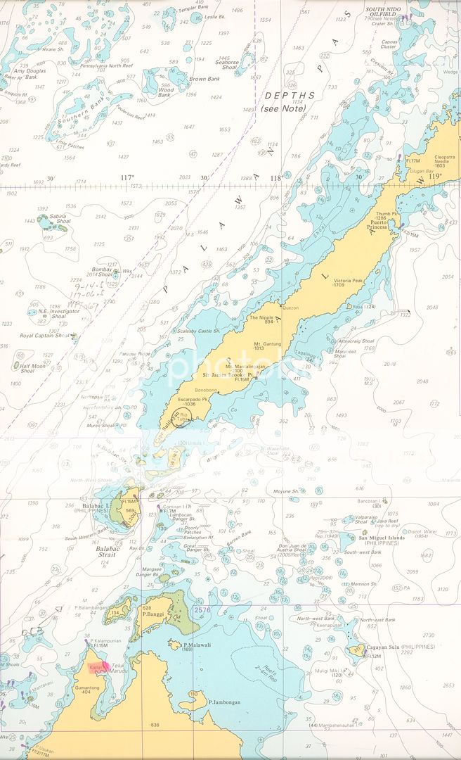
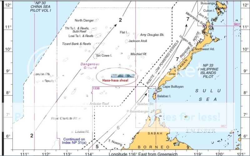
Palawan - Kalayaan Island Group - Spratly Islands Group


* * * * *
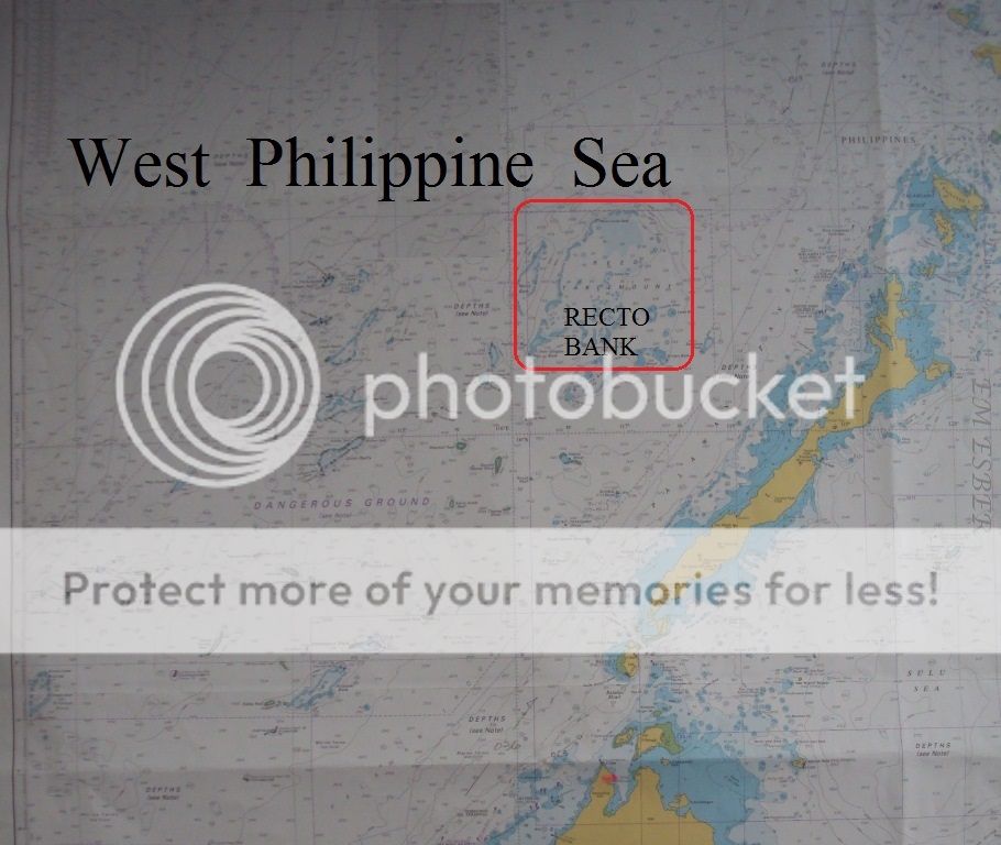
RECTO BANK OR REED BANK


* * * * *
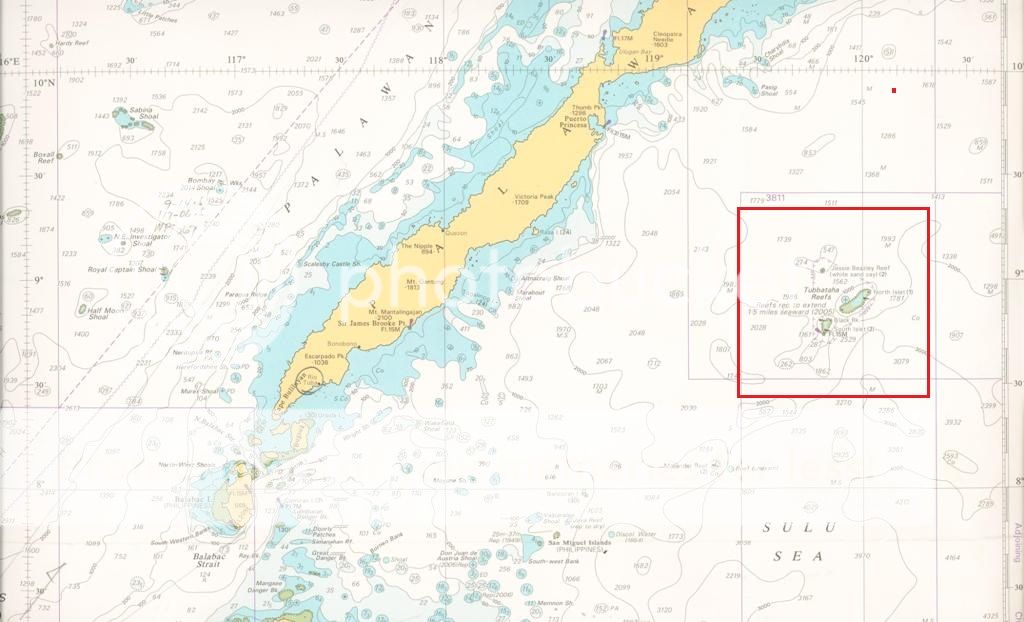
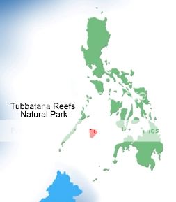
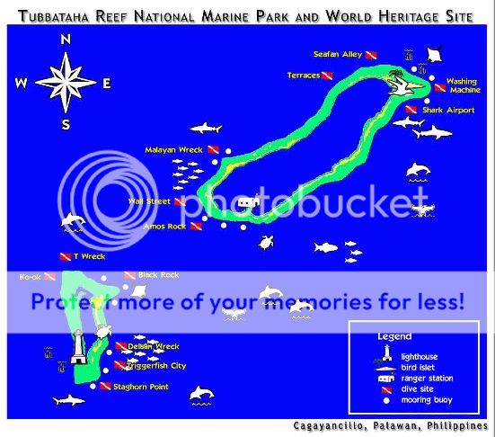
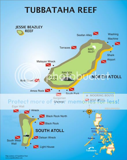
PALAWAN AND OILFIELDS TO TUBBATAHA REEF


* * * * *
Related Story :
Scarborough
Shoal
http://jibraelangel2blog.blogspot.com/2016/06/scarborough-shoal-101.html
Three
Centuries of Philippine Maps - 1598 to present era.
http://jibraelangel2blog.blogspot.com/2015/11/three-centuries-of-philippine-maps-1598.html
http://jibraelangel2blog.blogspot.com/2015/11/spratly-islands-and-bajo-de-masinloc-in.html
No comments:
Post a Comment