Rizal Park - Luneta
Roxas Blvd and Bonifacio Drive
Roxas Blvd looking towards south from Rizal Park.
Rizal Park looking towards west.
The Lapu-Lapu moniment at the east part of Rizal Park near Taft Avenue.
Lapu-Lapu monument
Taft Avenue end of Rizal Park
Roxas Boulevard
Roxas Boulevard adjacent to CCP Complex.
Baywalk of Roxas Blvd adjacent to Manila Yatch Club basin.
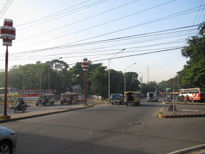
Corner of Roxas Blvd and Quirino Avenue
Manila Yatch Club basin
Roxas Blvd infront of Raja Soliman Park at Malate
View of the south part of U.S. Embassy complex
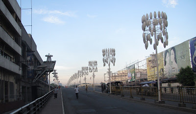
View from the pedestrian bridge near the US Embassy - looking towards south.
View from the pedestrian bridge near the US Embassy - looking towards north /
towards Rizal Park. On the left is the sidewalk adjacent to US Embassy.
Forbidden to take frontal photo shots of the US Embassy buildings, as the Police will be looking
for you once you appeared in the CCTV of the US Embassy complex. Anyhow the police will just
politely asked you where you will use the photos of the Embassy, the police officer will ask and
record your ID cards and of course for prudent sake it is better to show to the Police that you
have erased the mentioned photos.
Corner of Roxas Blvd and UN Avenue
Roxas Blvd at the vicinity of US Embassy.
Roxas Blvd near the vicinity of Rizal Park
Sta Cruz district of Manila
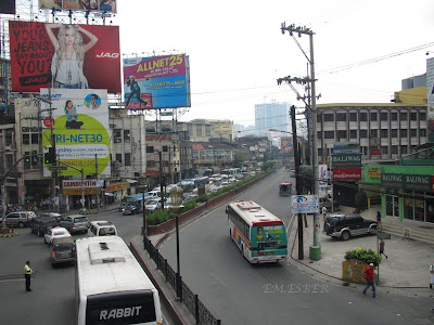
Rizal Avenue near Carriedo LRT Station.
Carlos Palanca Street (formerly Echague Street) near MacArthur Bridge.
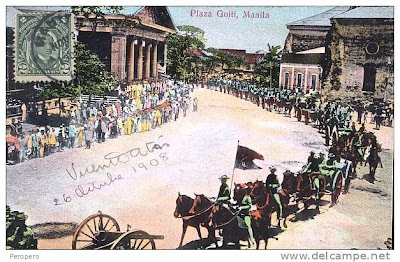
Plaza Lacson in Sta. Cruz was formerly called Plaza Goiti in honor of Manila’s greatest mayor,
Arsenio Lacson whose statue stands at the plaza. The former name was in honor of the
conquistadore, Martin de Goiti.
Old photos of Plaza Goiti now named as Plaza Lacson
MacArthur Bridge
Northward view of Tondo and Sta Cruz district from the top
of LRT's Doroteo Jose Station.
Northward view of Sta Cruz district from the top
of LRT's Doroteo Jose Station.
Southward view from the top of LRT's Doroteo Jose Station,
looking towards Pasig River area.
Sampaloc district of Manila
España Street corner P. Campa Street.
View of Pasig River from MacArthur Bridge
View between MacArthur bridge and Jones Bridge.
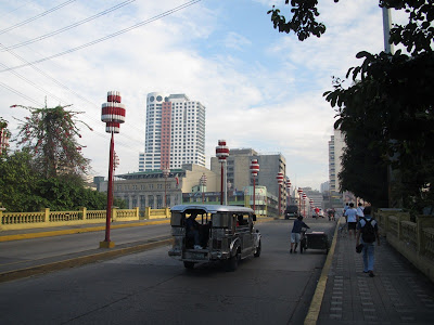
MacArthur Bridge looking towards south or towards Ermita.
Liwasang Bonifacio formerly named Plaza Lawton
Jones Bridge looking towards Binondo (China town)
Old photo of
Old photo of Calle Rosario
Bridge of Spain now named as Jones Bridge.
View from Jones Bridge - north bank of of Pasig River at Binondo.
View from Jones Bridge - looking towards west or towards Del Pan Bridge
and Manila Bay.
View from Jones Bridge - Looking towards Intramuros area.
View from the foot of Jones Bridge - looking towards south or
towards City Hall.
Intramuros
View from Intramuros of Pasig River and Binondo district.
Aduana Street - looking towards west or towards port area.
Aduana Street - looking towards west or towards port area.
The reconstructed Ayuntamiento where the Bureau of Treasury will be housed.
Ayuntamiento 1907
Palacio del Gobernador

View of Anda circle from Intramuros
Anda Circle looking towards south or towards Bonifacio Drive
and Roxas Blvd.
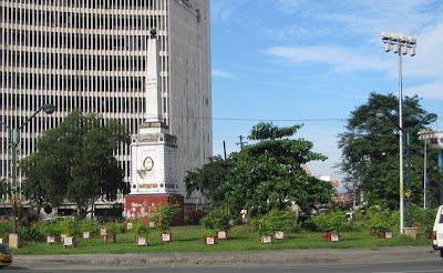
View of Anda Monument
The original Anda Monumento was located at the south bank
of Pasig River near the present Del Pan Bridge.
Old photo of Pasig River and the Anda Monument.
Path leading to Puerta del Parian of Intramuros
in the Philippines; no other surviving building in the Philippines has been claimed
to pre-date San Agustin Church.
View of Pasig River from Fort Santiago
View of Del Pan Bridge and San Nicolas district.
"Living life as an inspiring journey is priceless when shared" – Dr. Wends



















No comments:
Post a Comment