On
the 18th of May 2014, together with my daughter and her bestfriends April and Jay Ar, we set off for Tagaytay City.
We depart from our house in Mabalacat Pampanga at about 0630 hours and arrived
in Manila at about 0800 hours.
Our original travel plan is to follow the route of Coastal Highway and Aguinaldo Highway, however
due to late turning from Roxas Boulevard; we end up in CAVITEX (Cavite
Expressway) instead of Coastal Highway. Coastal Highway and CAVITEX were both
at the south terminus of Roxas Boulevard. At CAVITEX we decided to
exit at Bacoor Tollgate and proceeded to Bacoor town proper. At Bacoor we accessed the Aguinaldo Highway which is straight to Tagaytay
Town.
At
about 1100 hours we arrive in Tagaytay City proper. Though the sun was so
bright just like in Pampanga and Metro Manila, the temperature was not so hot
since Tagaytay City is about 2,000 feet above sea level. We
have our early lunch at Pamana Restaurant where we have a wide view of Taal
Lake and the volcano. Then we proceeded to “People’s Park in the Sky” formerly
named “Palace in the Sky” which was built during the Marcos era. From the
People’s Park in the Sky we can view the whole Taal Lake / Volcano and some towns of Batangas and Laguna Province and the beautiful and luxuriousTagaytay Higlands.
The City of Tagaytay is a component city in the province of
Cavite in the Philippines. It is one of the country's most popular tourist
destinations because of outstanding scenery and cooler climate provided by its
high altitude. Tagaytay overlooks Taal Lake in Batangas and provides one
of the iconic views of the Philippines, the view of Taal Volcano Island
in the middle of the lake, viewable from several vantage points in the city.
Tagaytay is relatively close to the capital city of Manila, only 55 km (34 mi) away via Aguinaldo Highway, providing an easy escape
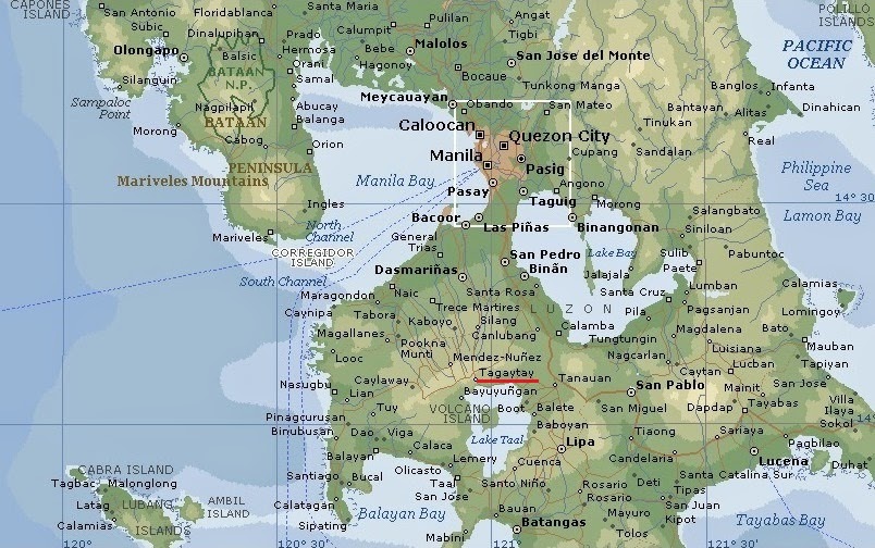
for the locals from the heat of the big city.Tagaytay City has a total land area of 66.1 km2 (26 sq mi) which represents about 4.37% of the total area of the Province of Cavite. It lies within 120° 56' longitude and 14° 6' latitude and overlooks Manila Bay to the North, Taal Volcano and Lake to the south and Laguna de Bay to the east.
Topography
The southern and eastern portions of Tagaytay City are covered by hills and mountains which is generally forests and open grasslands. The city lies along Tagaytay Ridge, a ridge stretching about 32 kilometres (20 mi) from Mount Batulao in the west to Mount Sungay (now People's Park in the Sky) in the east with elevations averaging about 610 metres (2,000 ft) above sea level.[4] Mount Sungay, in Tagaytay, is the highest point of the province of Cavite at 709 metres (2,326 ft).
The ridge, which overlooks Taal Lake in Batangas province, is actually the edge of
Taal Caldera. The 25-by-30-kilometre (16 mi × 19 mi) wide cavity
is partially filled by Taal Lake. Tagaytay's built-up areas including
the urban center is situated in the relatively level top of the caldera rim but
beyond the edge are deep ravines that drop straight down to Taal Lake. The
portions adjoining the municipalities of Mendez, Indang, Amadeo and Silang are level to nearly level areas
interspersed with very gently sloping surface. Across the southern edge of the
lake on the opposite side of the city is Mount Macolod, the highest point of the Taal
Caldera rim.
Climate
Temperature and precipitationTagaytay City's subtropical-like climate is characterized by relatively low temperature, low humidity and abundant rainfall. The City is endowed with a cool and invigorating climate with an average temperature of 22.7 °C (72.9 °F). With its high elevation, the city could be misty at times and is relatively cooler during the months of December, January and February. Like most areas in the province of Cavite, the city has two pronounced seasons: dry from November to April and wet during the rest of the year. The climate has made the city ideal for sports, picnics, conferences, honeymoons, country homes, and spiritual retreats.
Humidity
Tagaytay has an average humidity of 78% which makes the city cooler than Metro Manila where relative humidity exceeds 81%. Northeasterly winds prevail in the City from October to April. Winds come from southwest from May to September. The cool Tagaytay breeze has made the city ideal for casual and competitive kite flying.
Please read more at
the below web link :
http://en.wikipedia.org/wiki/Tagaytay
http://en.wikipedia.org/wiki/Tagaytay
Satellite photo of Taal Lake
Taal Lake is a freshwater lake in the province of Batangas, on the island of Luzon in the Philippines. The lake fills Taal Caldera, a large volcanic caldera formed by very large eruptions between 500,000 and 100,000 years ago. It is the country's third largest lake after Laguna de Bay and Lake Lanao. Volcano Island, the location of Taal Volcano's historical eruptions and responsible for the lake's sulfuric content, lies near the center of the lake. There is a crater lake on Volcano Island, which is the world's largest lake on an island (Volcano Island) in a lake (Taal Lake) on an island (Luzon). Known as the Main Crater Lake, it contains its own small island, Vulcan Point.
The Taal Lake basin was first declared as a national park, the Taal Volcano National Park, by Proclamation no. 235 on July 22, 1967 covering 62,292 hectares (153,930 acres).
Under Republic Act 7586, otherwise known as the National Integrated Protected Areas System (NIPAS) Act of 1992, the area was reestablished as the Taal Volcano Protected Landscape by Proc. 906 on October 16, 1996. The protected area is managed by a Protected Area Management Board (PAMB) and has a Chief Operating Officer called a Protected Area Superintendent. A Management Plan was crafted and approved by the PAMB in 2009 and now serves as the blueprint for lake conservation.
History
Taal Lake was once just an arm of Balayan Bay. However, after a series of major eruptions in the 18th century, Taal Lake's sole connection to the sea narrowed down into its sole draining river, the Pansipit River. Several centuries of precipitation have diluted the lake's once saline waters into freshwater.
Eruptions have also destroyed numerous lakeside towns, burying them with volcanic ash or submerged them by rising lake waters displaced by the erupted material. Lipa, Taal, Sala, Bauan and Tanauan were formerly located along Taal Lake. Presently, only three towns are on the lake's shore. Remnants of the old lakeside towns are reported to be seen under the lake's waters
Please read more at the below link :
http://en.wikipedia.org/wiki/Taal_LakeEruptions have also destroyed numerous lakeside towns, burying them with volcanic ash or submerged them by rising lake waters displaced by the erupted material. Lipa, Taal, Sala, Bauan and Tanauan were formerly located along Taal Lake. Presently, only three towns are on the lake's shore. Remnants of the old lakeside towns are reported to be seen under the lake's waters
Please read more at the below link :
* * * * * * * * * * * * * * *
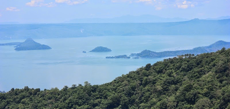
View of Taal Lake from Tagaytay City proper - 18th May 2014
View of Taal Lake and vicinity from Peoples Park, Tagaytay City
The People's Park in the Sky is a historical urban park in Tagaytay City, Cavite, Philippines.
The park was converted from an incomplete mansion, known as the Palace in the Sky built during the Marcos Era. The incomplete scaffolding of the
mansion was remained intact. The Shrine of Our Lady, Mother of Fair Love and a Doppler weather Radar station
maintained by the Philippine Atmospheric Geophysical and Astronomical Services Administration (PAGASA) is also within the park.
History
Imeda Marcos decided to build a mansion on top of Mount Gonzales (also known as Mount Sungay),
which was at that time a land owned by the government. The summit before was
used by the Bureau of Air Transport as a radar station. Construction of the
Palace in the Sky began in 1981. The construction of the mansion was a tedious
one as roads were built for supplies to reach the top of the 2,500 ft Mount
Gonzales. The mountain was leveled by bulldozers and farmers living on the mountainside
were asked to relocate. Construction of the mansion was hastened when US President Ronald Reagan announced his intention to visit the
Philippines in November 1983. It was reported that the Marcos administration
planned to accommodate Reagan at the Palace in the Sky. Post-People Power Revolution critics of the Marcos administration
described the unfinished mansion as a symbol of the Marcos administration's
excess.
Please read more at the below link :
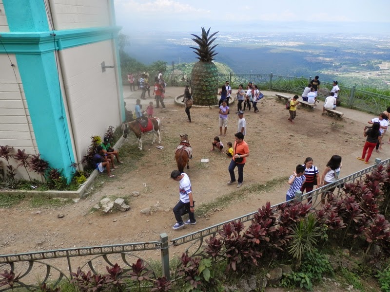
View from the "People's Park in the Sky
People's Park in the Sky (Mount Sungay)
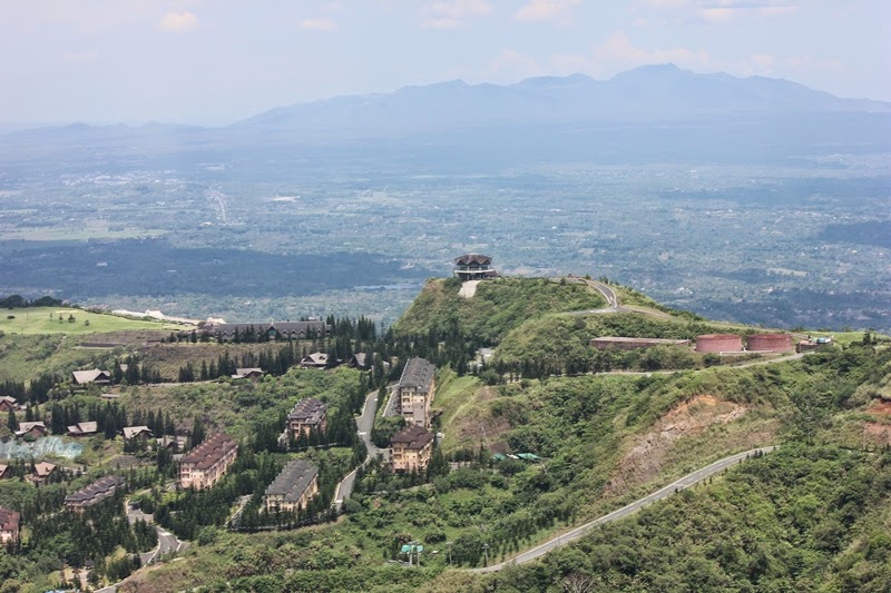
View of Tagaytay Highlands as seen from People's Park in the Sky
PAGASA'S Doppler Radar
Weather Radar also called Doppler weather radar, is a type of radar used to locate precipitation, calculate its motion, and estimate its type (rain, snow, hail, etc) Modern weather radars are mostly pulse-doppler radars, capable of detecting the motion of rain droplets in addition to the intensity of the precipitation. Both types of data can be analyze to determine the structure of storms and their potential to cause severe weather.
ATTRIBUTION LICENSE
You may use the pictures in this
blog under an Attribution License. You are free to use, share and modify the
pictures found in this blog. Should you publish or otherwise reproduce for
distribution the pictures found here in digital or printed form you must place
a link to this blog or indicate the URL of this blog in your publication.
Related web links :
http://en.wikipilipinas.org/index.php/Tagaytay_City
http://wikitravel.org/en/Tagaytay
http://www.tagaytay-highlands.com/25-reasons-to-visit-tagaytay-highlands.html
http://en.wikipedia.org/wiki/Taal_Volcano
http://www.geog.ucsb.edu/events/department-news/802/
Related web links :
http://en.wikipilipinas.org/index.php/Tagaytay_City
http://wikitravel.org/en/Tagaytay
http://www.tagaytay-highlands.com/25-reasons-to-visit-tagaytay-highlands.html
http://en.wikipedia.org/wiki/Taal_Volcano
http://www.geog.ucsb.edu/events/department-news/802/
Youtube Videos


No comments:
Post a Comment