
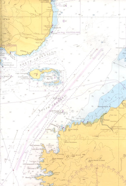
Manila Bay drains approximately 17,000 km2 (6,563.7 sq mi) of watershed area, with the Pampanga River contributing about 49% of the freshwater influx. With an average depth of 17 m (55.8 ft), it is estimated to have a total volume of 28.9 billion cubic meters (28.9 cubic km). Entrance to the bay is 19 km (11.8 mi) wide and expands to a width of 48 km (29.8 mi). However, width of the bay varies from 22 km (13.7 mi) at its mouth and expanding to 60 km (37.3 mi) at its widest point.
The islands of Corregidor and Caballo divides the entrance into two channels, about 2 miles (3.2 km) towards the North and 6.5 miles (10.5 km) wide on the South side. Mariveles, in the province of Bataan, is an anchorage just inside the northern entrance and Sangley Point is the former location of Cavite Naval Base. On either side of the bay are volcanic peaks topped with tropical foliage: 40 km to the north is the Bataan Peninsula and to the south is the province of Cavite.
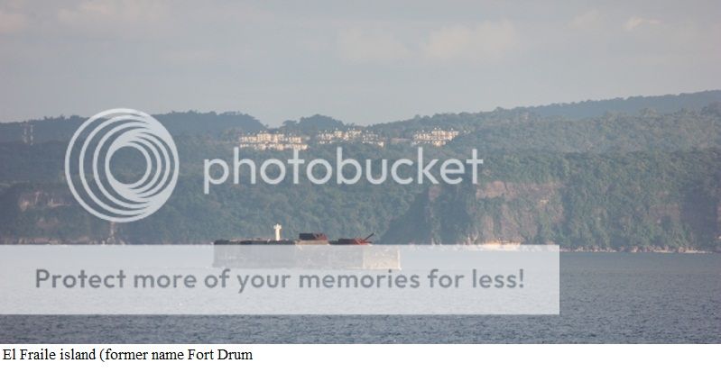
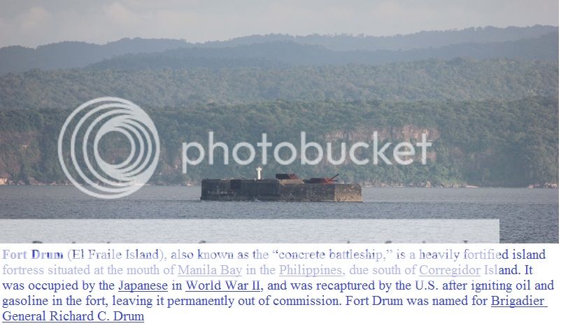
Across the entrance to Manila Bay are several islands, the largest of which is Corregidor, located 3 kilometers from Bataan and, along with the island of Caballo, separates the mouth of the bay into the North and South Channels. In the south channel is El Fraile Island and outside the entrance, and to the south, is Carabao Island. El Fraile, a rocky island some 4 acres (1.6 ha) in area, supports the massive concrete and steel ruins of Fort Drum, an island fortress constructed by the United States Army to defend the southern entrance of the bay. To the immediate north and south are additional harbors, upon which both local and international ports are situated. Large number of ships at the North and South harbors facilitate maritime activities in the bay. Being smaller of the two harbors, the North Harbor is used for inter-island shipping while the South Harbor is used for large ocean-going vessels.
(http://en.wikipedia.org/wiki/Manila_Bay)
Vessel coming to Manila Bay from north entered the bay through North Channel.
Mariveles is located in a cove at the southern tip of the Bataan Peninsula. It is about 173 kilometres (107 mi) from Manila via the North Luzon Expressway, Gapan-Olongapo Road and Roman Highway. It has a total land area of 153.9 square kilometres (59.4 sq mi), representing 12% of the total land area of Bataan. Of this, about 69% consist of the pastureland, 19% of forestland, 6% agricultural lands and the remaining 6% for residential and industrial use. It is home to an Aeta community speaking a Sambalic language called Mariveleño.
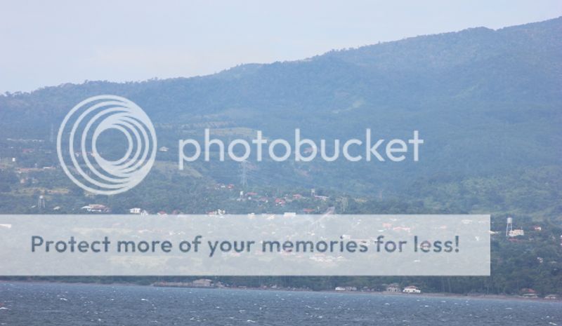
View of Mariveles Port located on the north side of North Channel / south coast
of Bataan Peninsula

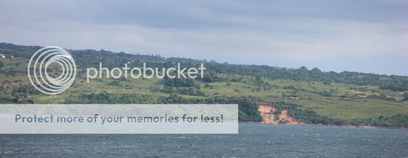
South west part of the coast of Mariveles Bataan.

Cochinos point located on west side Mariveles Harbor.
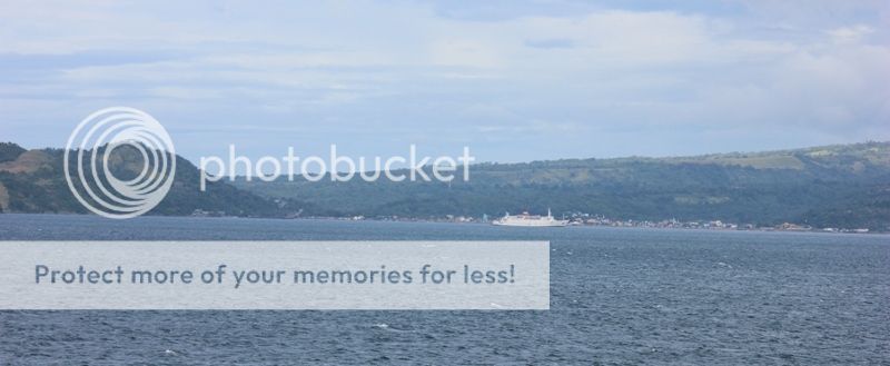
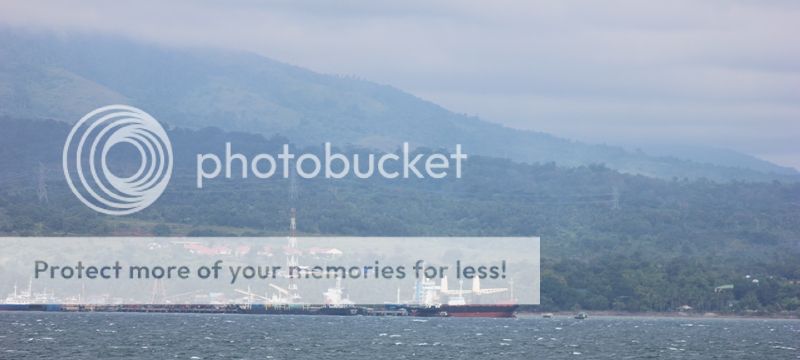
Mariveles Harbour

Mariveles Harbour

Mariveles Harbour

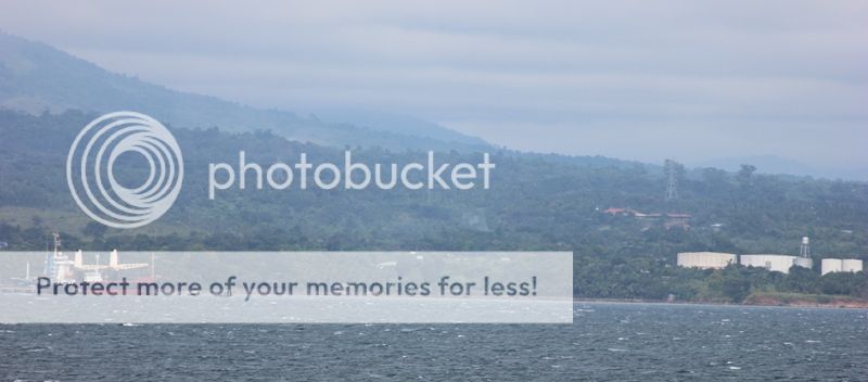
Mariveles Harbor

Gorda Point


Mariveles Coal-powered Power Plant located at Alasasin point in
Mariveles town.
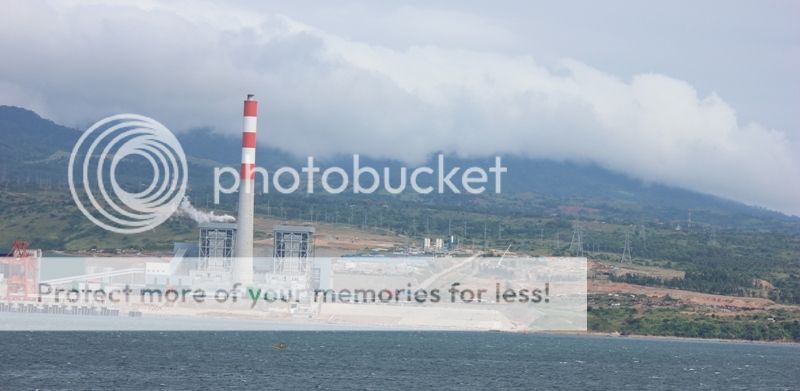


I am wondering why our smartboys in the Industry and government permitted the building of an Electric power plant on this vulnerable locations which is just half mile from the busy Traffic Separation Zone of North Channel.
It will be very difficult to secure these Electric power in case of war with other countries or from terrorist as this is located right beside the busy shipping traffic lane. Once the Power Plant is operating then those big vessels that will bring Coal to the Power Plant will be using the Pier which is adjacent to the Plant and just half-mile from the busy Traffic Separation Zone.
This Power Plant is built and/ or owned by Peoples Republic of China's - China National Electric Engineering Co. Ltd.
I also cannot understand why our Philippine government have allowed China to participate in the
building of an Electric Power Plant since the Peoples Republic of China is our potential enemy in the near future. China themselves may sabotaged the Electric Power Plant incase of war between China and the Philippines.


Mariveles Coal-powered Power Plant located at Alasasin point in
Mariveles town.


View of Corregidor island from the hills of Mariveles.

View of the Coal-powered Electric Power Plant and Corregidor island
from the hills of Mariveles.


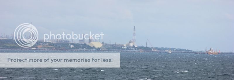
Oil Refinery at Limay Bataan

Oil Refinery at Limay Bataan and anchorage area.
http://marivelesbataan.gov.ph/
China National Electric Engineering Co. Ltd.
http://www.cneec.com.cn/Achievements/sygd/201006/1032.html.
http://www.cneec.com.cn/Achievements/sygd/201006/1032.html.
SAVE OUR EARTH ..... SAVE OUR LIFE
MARIVELES BATAAN COAL POWER PLANT
http://saveourearthsaveourhome.blogspot.jp/2011/03/mariveles-bataan-coal-power-plant.html
Port of Mariveles and the coal-run Power Plant in Mariveles
http://jibraelangel2blog.blogspot.jp/2012/09/mariveles-port-and-coal-run-power-plant.html

Corregidor Island, locally called Isla ng Corregidor, is a lofty island located at the entrance of Manila Bay in southwestern part of Luzon Island in the Philippines. Due to this location, Corregidor was fortified with several coastal artillery and ammunition magazines to defend the entrance of Manila Bay and the City of Manila from attacks by enemy warships in the event of war. Located 48 kilometres (30 mi) inland, Manila has been the largest city and the most important seaport in the Philippines for centuries, from the colonial rule of Spain, the United States, and Japan and after the establishment of the Republic of the Philippines in 1946.
Corregidor (Fort Mills) is the largest of the islands that formed the harbor defenses of Manila Bay together with El Fraile Island (Fort Drum), Caballo Island (Fort Hughes) and Carabao Island (Fort Frank), which were all fortified during the American occupation of the country. The island was also the site of a small military airfield, as part of the defense.
During World War II, Corregidor played an important role during the invasion and liberation of the Philippines from Japanese forces. Heavily bombarded in the latter part of the war, the ruins left on the island serve as a military memorial to American, Filipino and Japanese soldiers who served or lost their lives on the island. Corregidor is one of the important historic and tourist sites in the country.
Spanish colonial era
The island came under Spanish sovereignty since May 19, 1570 when Miguel Lopez de Legazpi and his forces arrived in Manila Bay. Legazpi was authorized by the Spanish Crown to establish the capital of the Philippines in Manila, and convert the Muslims from Luzon and Mindanao to Christianity. Corregidor was used as a support site for the nine Spanish galleys used during the campaign.
Under the Spanish rule, Corregidor served not only as a fortress of defense, a penal institution, and a station for Customs inspection, but also as a signal outpost to warn Manila of the approach of hostile ships. Corregidor comes from the Spanish word corregir, meaning "to correct." One story states that the island was called Isla del Corregidor (literally, Island of Correction) due to the Spanish customs system, wherein all ships entering Manila Bay were required to stop and have their documents checked and "corrected". Another version claims that the island was used a penitentiary or correctional institution by the Spanish government, and thus came to be called El Corregidor
Corregidor is also a specific position of authority within the former Spanish administrative structure. He is the head of the territorial unit known as Corregimiento. The institution of administrative districts called Corregimientos (with the chief, "El Corregidor") was in use throughout Spanish America and the Philippines. Just as an example, in the Philippines had "corregidores" in charge of Bataan and Zambales, among other "Isla del Corregidor", the ancient name of the place, literally means "Corregidor's island".
On November 23, 1574, the Chinese pirate Limahong and his 65 vessel fleet, with 3,000 men anchored between Corregidor and Mariveles. From that site he launched two successive attacks against Manila, commanded either by Limahong himself or the Japanese Sioco. Both of them failed their purpose before a fierce battle defense led by the governor Juan de Salcedo.
In November and December 1600, the surroundings of Corregidor Island were used as berth by the Dutchman Olivier van Noort. His sailboats Mauritius and Hendracht were engaged in pirate activities on the sailing route to and from Manila. This situation was overcome after the naval combat of Fortune Island on December 14, 1600. As a result, Spain lost its ship San Diego but captured the Dutch sailing boat Hendracht and Oliver van Noort retired from the Philippines.
As a consequence of these events, and also to prevent a sneak attack by the Muslims from Mindanao, a watch vessel was settled in Corregidor to control the entrance to the bay. According to data from 1637, this vessel had a crew of twenty men, who were paid 540 pesos a year to perform this vigilance task.
Corregidor Island was taken over by the Dutch in June 1647 and from there they launched an offensive against Cavite which was repelled by the Spanish garrison, under command of Andre Lopez de Azalduigui. However, the Dutchmen would remain in the island for seven more months as it served them well as an operations base to intercept Chinese merchant traffic in the vicinity of Luzon and Cebu. Finally they withdrew with little of their expectations fulfilled.
During the British attack and its following invasion of Manila and Cavite in October 1762 by the Royal Navy and the British Army troops of Admiral Cornish and General Draper, Corregidor was used as an anchorage for warships, particularly the HMS Panther and the captured warship, the Spanish galleon Santisima Trinidad, during November 1762.
The arrival of the Spanish fleet, led by General Ignacio Mario de Alava, with the mission to place the Philippine Islands on alert, did not affect the luck of Corregidor Island. He limited his activity to the setting up of a naval station at Cavite.
On January 18, 1853, the Corregidor Island Lighthouse was first lit on the highest part of the island to mark the entrance of Manila Bay to vessels coming in from the South China Sea. The Spanish government built the Second-Order light, which is situated 639 feet (195 m) above sea level and visible for 20 miles (32 km).[10]
Spanish-American War
Corregidor Island was included in the Philippines defense plan presented in 1885 by General Cerero, but no action was taken. When the U.S. Navy's attack was thought to be imminent, a 12 cm gun, the "Hontoria System", which came from the Spanish Navy's cruiser Antonio de Ulloa and two shorter ones of the same caliber, from the Spanish warship Lezo, were installed on the rocky island El Fraile. On the south side of Corregidor, the Spanish army installed three 18 cm artillery pieces which came from the Spanish navy cruiser Velasco which was undergoing reparation works.
On the midnight of April 30 to the 1st of May 1898, U.S. Navy Commodore George Dewey led his naval squadron, with his flag hoisted on board the armored cruiser USS Olympia, eastward along the southern coast of Corregidor Island, beyond the reach of Spanish batteries and with no navigational lights on.
At a distance about one mile off El Fraile, Dewey's fleet changed course to the North East, steaming towards Manila. When they were discovered, the Spaniards fired from El Fraile's artillery. American response followed immediately, first by the McCulloc and then by the Boston, Raleigh and Concord. Since the fleet speed was ten knots, they were soon far away from the Spanish batteries. Dewey sailed for Cavite where he destroyed the naval forces of Admiral Monojo.
Once the Cavite shipyard was subdued by means of a Stipulated Pact, two American ships went ashore at Corregidor Island on the 3rd of May forcing the Spaniards on the island to surrender. Colonel Garces, chief of the coast batteries at the entrance of Manila's Bay, and the island's governor, First Class Naval Lieutenant, Augusto Miranda, were urged to come to terms with the Americans, and so they did. Therefore, Miranda remained on the island with only 100 soldiers and the Spanish Flag on top; Garces and officers under his command, as well as 292 men with their weapons and ammunition, were transferred to the Mariveles port. From there they were conducted along the provinces of Bataan and Pampanga until they reached Manila on the 5th of May. There they joined the Navy battalion which was already quartered in Sampaloc.
On the 4th of May, the American ships opened fire against the 100 men who, according to the pact had been left on Corregidor and demanded the garrison forces be reduced to 25 men. The Spanish governor consulted Manila authorities, and they ordered the evacuation of the island. The troops were sent to Naic, Cavite on boats while the governor was transferred to the American cruiser USS Baltimore and became a prisoner with his family. The Americans offered to liberate him but the Navy Lieutenant rejected. Shortly afterwards, he was disembarked in Balanga, Bataan. In this way, the Spanish presence on Corregidor Island, which had lasted 328 years, came to an end.
American Colonial Period
In 1902, the island was organized as an American military reservation. In 1903, a convalescent hospital was established by the United States Army.
The Board of Fortifications chaired by William H. Taft recommended that key harbors of territories acquired after the Spanish-American War be fortified. Consequently Corregidor was fortified and incorporated into the harbor defenses Manila and Subic Bays. In 1908, a Regular Army post was established on the island, designated as Fort Mills, in honor of Brigadier General Samuel Meyers Mills, Jr., Chief of Artillery of the U.S. Army from 1905 to 1906. By early 1909, H Company of the 2nd Battalion of the Corps of Engineers was assigned to Corregidor and started on the construction of concrete emplacements, bomb-proof shelters, and trails at various parts of the island. This pioneer engineer company left Fort Mills on March 15, 1912. All or part of 35 different numbered Coast Artillery Corps companies served tours at Fort Mills between 1909 and 1923.
The defense of Corregidor was the immediate responsibility of the Philippine Coast Artillery Command, commanded by Major General George F. Moore at the start of World War II. Stationed on the island after the return to the regimental system in 1924 were the following regular units:
( http://en.wikipedia.org/wiki/Corrigidor )
Views of the north coast of Corregidor island from
North Channel.


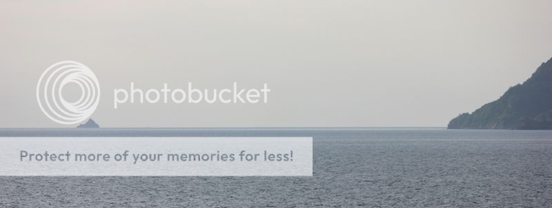
West of Corregidor island is the island of La Monja.


About half mile from La Monja island.


Near the wake of our ship's propeller is the small island of La Monja.

North west part of Corregiodr island.

North west part of Corregidor island


North part of Corregidor island.


North - middle part of Corregidor island.

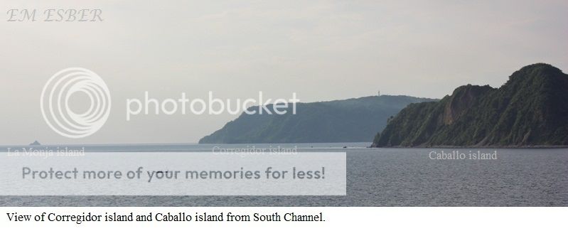
Views of Corregidor island and Caballo island from
South Channel

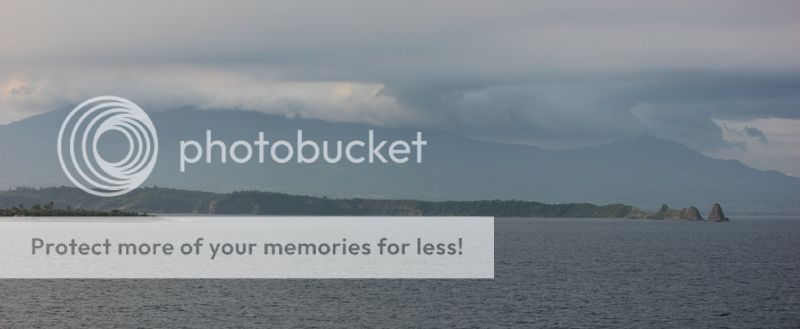
View of Caballo island, Corregidor island and the mountain range of Bataan.

View of Caballo island, Corregidor island and the mountain range of Bataan.
View of La Monja island and the south west part of Corregidor island.


View of the south part of Corregidor island and the west end of Caballo island.

Caballo island

View of the east end of Caballo island, east end of Corregidor island and
the mountain range of Bataan Peninsula.


On the south part of Corregidor's South Channel is the Province of Cavite with the prominent points of Caballo island and El Fraile island.


Youtube Video :
MV Eastern Galaxy entering Manila Bay via North Channel
Related websites :
http://marivelesbataan.gov.ph/
Port of Mariveles and the coal-run Power Plant in Mariveles, Bataan
http://jibraelangel2blog.blogspot.jp/2012/09/mariveles-port-and-coal-run-power-plant.html
China National Electric Engineering Co. Ltd.
http://www.cneec.com.cn/Achievements/sygd/201006/1032.html.
China National Electric Engineering Co. Ltd.
http://www.cneec.com.cn/Achievements/sygd/201006/1032.html.
SAVE OUR EARTH ..... SAVE OUR LIFE MARIVELES BATAAN COAL POWER PLANT
http://saveourearthsaveourhome.blogspot.jp/2011/03/mariveles-bataan-coal-power-plant.html
The Mindanao Conflict and the
Jabidah Massacre
http://jibrael.blogspot.jp/2007/05/mindanao-conflict.html
Fort Drum / El Fraile island - ( off Cavite Province )
http://www.pacificwrecks.com/gun/philippines/fort_drum/index.html
http://corregidor.org/chs_battery1/drum.htm
http://jibrael.blogspot.jp/2007/05/mindanao-conflict.html
Fort Drum / El Fraile island - ( off Cavite Province )
http://www.pacificwrecks.com/gun/philippines/fort_drum/index.html
No comments:
Post a Comment